MyTopo
Maidstone Lake Vermont US Topo Map
Couldn't load pickup availability
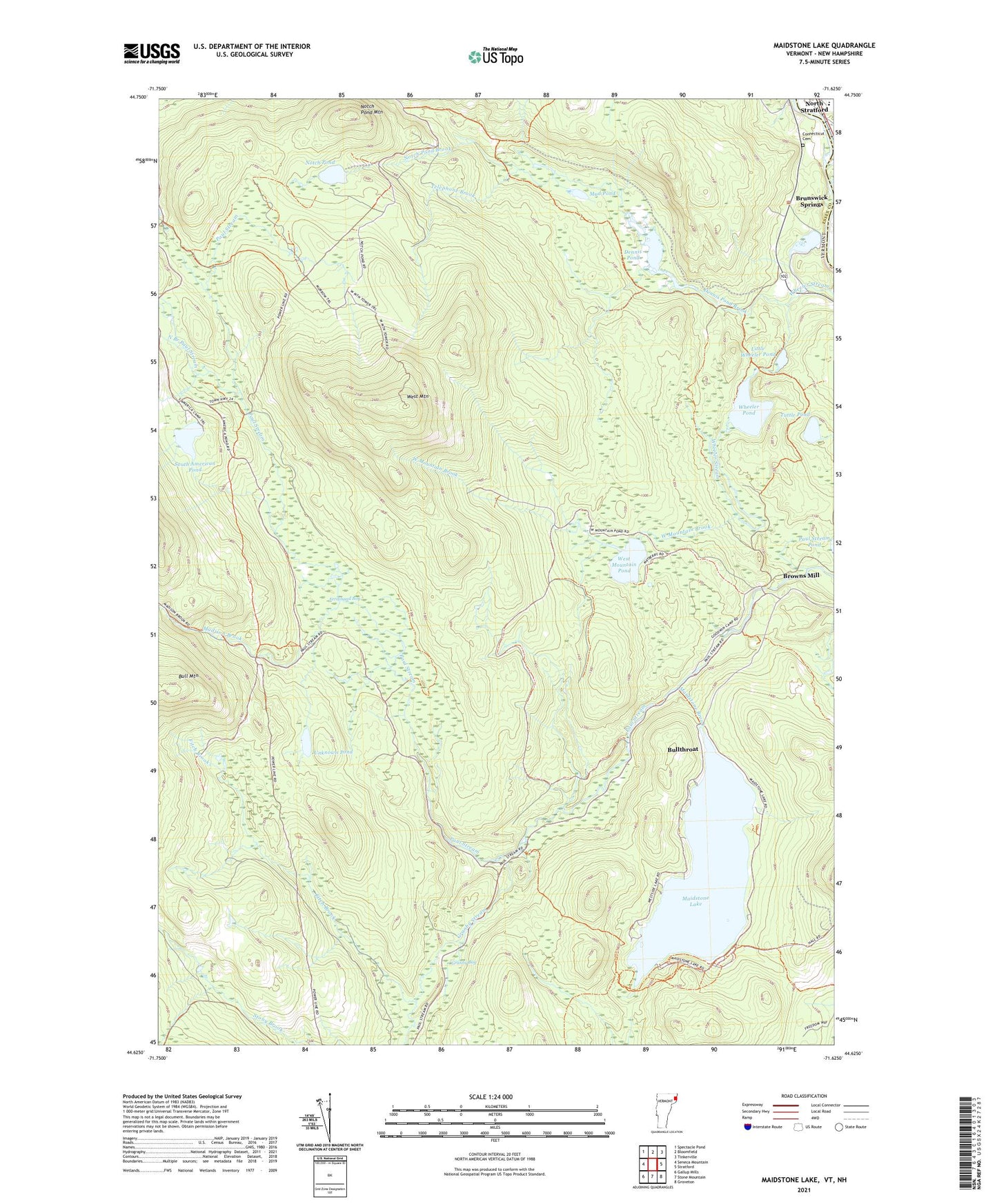
2024 topographic map quadrangle Maidstone Lake in the states of New Hampshire, Vermont. Scale: 1:24000. Based on the newly updated USGS 7.5' US Topo map series, this map is in the following counties: Essex, Coos. The map contains contour data, water features, and other items you are used to seeing on USGS maps, but also has updated roads and other features. This is the next generation of topographic maps. Printed on high-quality waterproof paper with UV fade-resistant inks.
Quads adjacent to this one:
West: Seneca Mountain
Northwest: Spectacle Pond
North: Bloomfield
Northeast: Tinkerville
East: Stratford
Southeast: Groveton
South: Stone Mountain
Southwest: Gallup Mills
This map covers the same area as the classic USGS quad with code o44071f6.
Contains the following named places: Browns Mill, Brunswick Springs, Bull Mountain, Bullthroat, Camping Area A, Camping Area B, Connecticut Cemetery, Dennis Pond, Dennis Pond Brook, Essex County, Ferdinand Bog, Fitch Brook, Granby Bog, Granby Stream, Little Wheeler Pond, Loon Trail, Madison Brook, Maidstone Brook, Maidstone Lake, Maidstone State Park, Maidstone State Park Nature Center, Moose Trail, Mud Pond, North Branch Paul Stream, Notch Pond, Notch Pond Brook, Notch Pond Mountain, Shore Trail, South American Pond, Stratford Elementary School, Stratford High School, Telephone Brook, Town of Brunswick, Tuttle Pond, Unknown Pond, Walker Dam, West Mountain, West Mountain Brook, West Mountain Pond, Wheeler Pond, ZIP Code: 05905