MyTopo
Beach Virginia US Topo Map
Couldn't load pickup availability
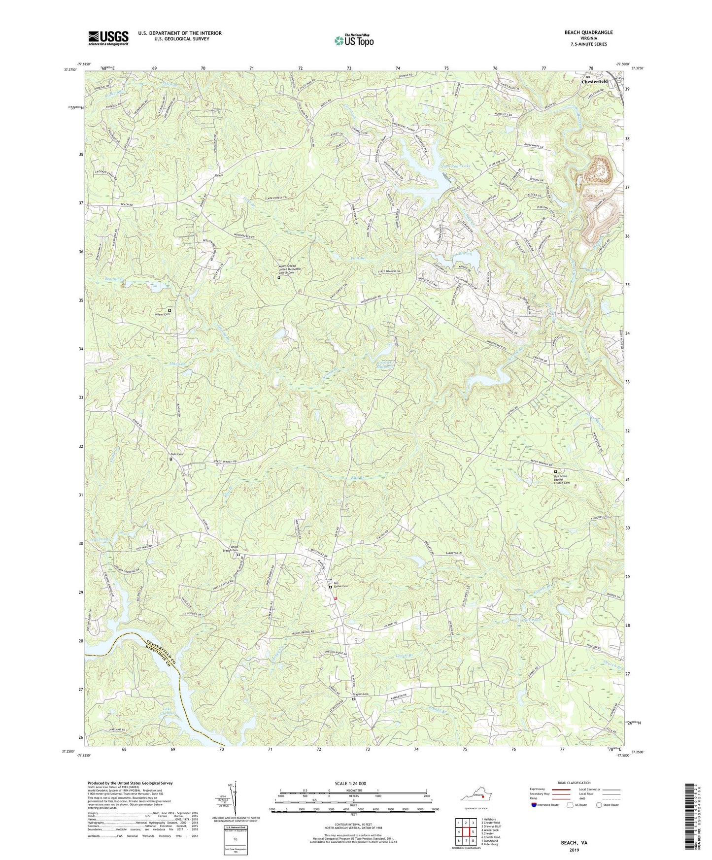
2023 topographic map quadrangle Beach in the state of Virginia. Scale: 1:24000. Based on the newly updated USGS 7.5' US Topo map series, this map is in the following counties: Chesterfield, Dinwiddie. The map contains contour data, water features, and other items you are used to seeing on USGS maps, but also has updated roads and other features. This is the next generation of topographic maps. Printed on high-quality waterproof paper with UV fade-resistant inks.
Quads adjacent to this one:
West: Winterpock
Northwest: Hallsboro
North: Chesterfield
Northeast: Drewrys Bluff
East: Chester
Southeast: Petersburg
South: Sutherland
Southwest: Church Road
This map covers the same area as the classic USGS quad with code o37077c5.
Contains the following named places: Beach, Camp Baker, Carson Volunteer Fire Department Substation, Cattle Creek, Chesterfield Fire and Emergency Medical Services Station 13 Phillips, Chesterfield Meadows Shopping Center, Chesterfield Post Office, Crostick Dam, Crostick Millpond, Dahl Cemetery, Dale Quarry, Fendley, First Branch, Gill Grove Cemetery, Gill Grove Church, Gills Pond, Highlands Golfers Club, Ivys Ponds, Lake Dale, Lake Dale Dam, Lake Margaret, Lake Margaret Dam, Lake Neda, Leader, Lees Chapel, Licking Creek, Locust Branch, Mann Branch, Mount Gilead Church, Mount Gilead United Methodist Church Cemetery, Nash Grove, Nash Road Lake, Nash Road Lake Dam, Oak Grove Baptist Church, Oak Grove Baptist Church Cemetery, Phillips Station Number 13, Piney Branch, Pocahontas State Forest, Rita Branch, Rocky Run, Rudy Store, Second Branch, Shoosmith Sanitary Landfill, Southern Area Landfill, Traylor Cemetery, Union Branch Cemetery, Union Branch Church, Union Branch Elementary School, Union Grove Church, Union Grove School, Vaughn Dam, Wilson Cemetery