MyTopo
Mechanicsburg Virginia US Topo Map
Couldn't load pickup availability
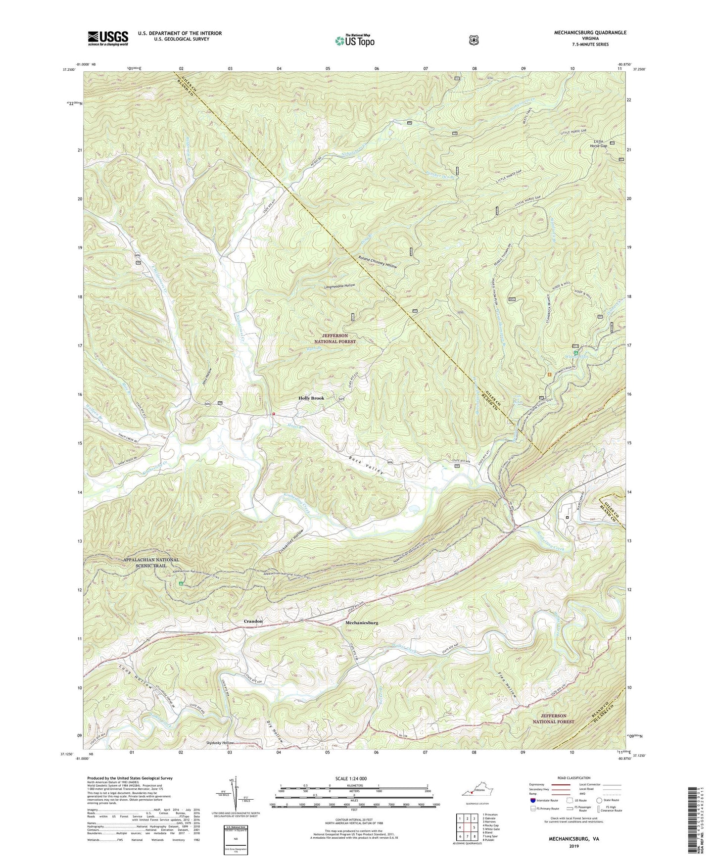
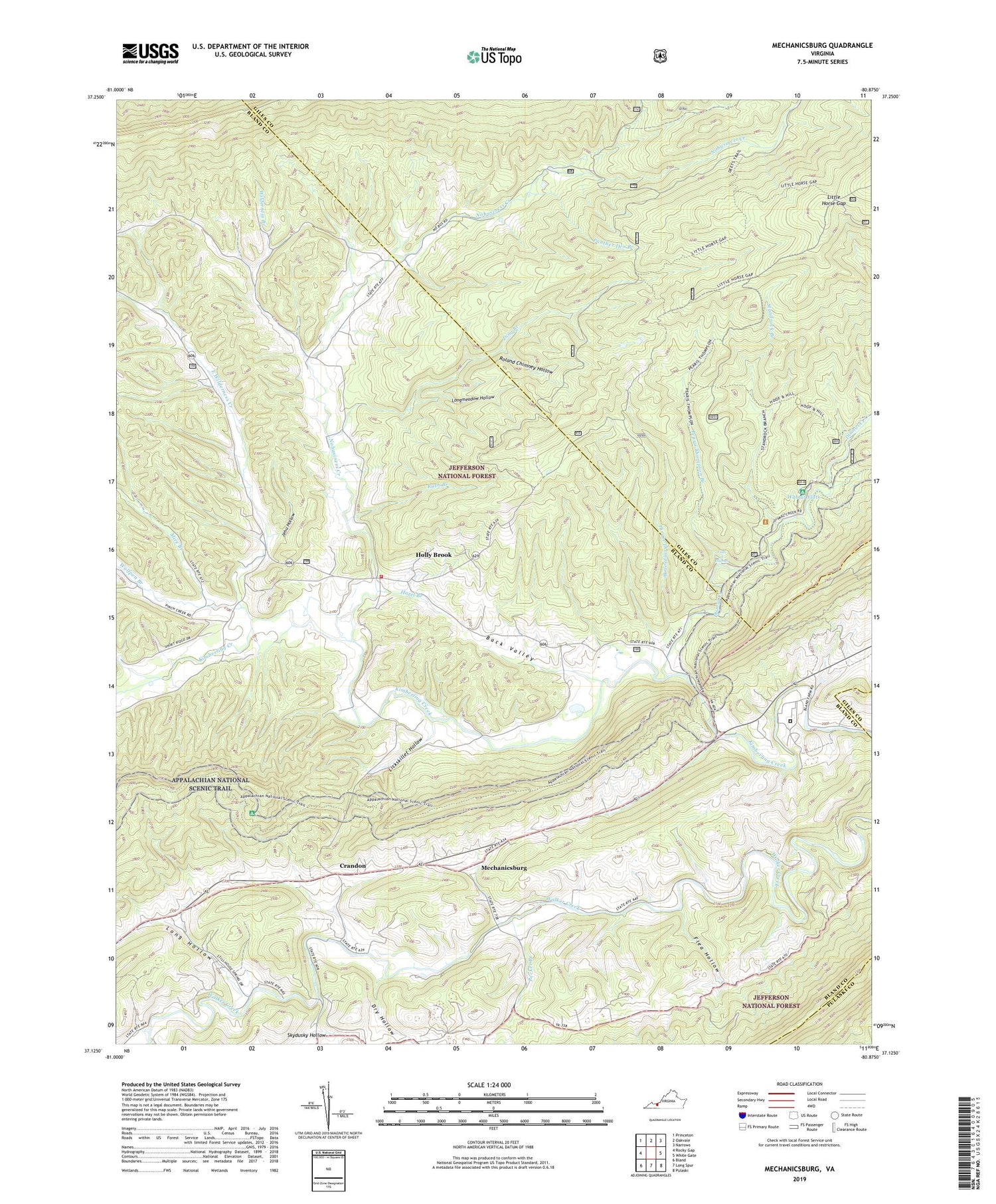
2019 topographic map quadrangle Mechanicsburg in the state of Virginia. Scale: 1:24000. Based on the newly updated USGS 7.5' US Topo map series, this map is in the following counties: Bland, Giles, Pulaski. The map contains contour data, water features, and other items you are used to seeing on USGS maps, but also has updated roads and other features. This is the next generation of topographic maps. Printed on high-quality waterproof paper with UV fade-resistant inks.
Quads adjacent to this one:
West: Rocky Gap
Northwest: Princeton
North: Oakvale
Northeast: Narrows
East: White Gate
Southeast: Pulaski
South: Long Spur
Southwest: Bland
Contains the following named places: Back Valley, Bland Correctional Center, Brick Church, Brushy Ridge, Byrnes Chapel Methodist Church, Crandon, Ding Branch, Dismal Creek, District 3, Double Mountain, Dry Hollow, East Wilderness Creek, Falls of Dismal, Flea Hollow, Gauley Ridge, Hazel Branch, Hiram Thompson Branch, Holly Brook, Hollybrook - Mechanicsburg Volunteer Fire Department, Hoof and Hill Trail, Jehu Hollow, Jenny Knob, Lickskillet Hollow, Little Horse Gap, Long Hollow, Longmeadow Hollow, Mechanicsburg, Mechanicsburg Census Designated Place, Mechanicsburg District, Middle Ridge, Mire Branch, Nobusiness Creek, Panther Den Branch, Pearis Thompson Branch, Pearis Thompson Horse Trail, Pecker Branch, Radford Army Ammunition Fire Department and Rescue Squad, Roland Chimney Hollow, Rush Branch, Shady Grove Church, Shiloh Church, Shingleblock Ridge, Short Ridges, Silver Creek School, Skydusky Hollow, Standing Branch Horse Trail, Standrock Branch, Stange Mines, Turkey Ridge, Walnut Flats, Walnut Flats Campground, Wessendonck Church, White Pines Horse Camp, Wilderness Branch, Wolfpen Branch