MyTopo
Skippers Virginia US Topo Map
Couldn't load pickup availability
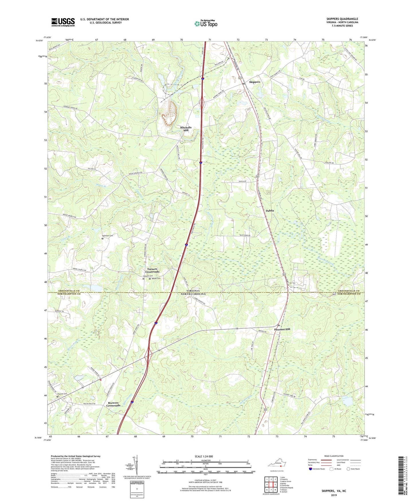
2019 topographic map quadrangle Skippers in the states of Virginia, North Carolina. Scale: 1:24000. Based on the newly updated USGS 7.5' US Topo map series, this map is in the following counties: Greensville, Northampton. The map contains contour data, water features, and other items you are used to seeing on USGS maps, but also has updated roads and other features. This is the next generation of topographic maps. Printed on high-quality waterproof paper with UV fade-resistant inks.
Quads adjacent to this one:
West: Barley
Northwest: Ante
North: Emporia
Northeast: Adams Grove
East: Claresville
Southeast: Jackson
South: Weldon
Southwest: Roanoke Rapids
Contains the following named places: Antioch Church, Beaverpond Creek, Brewers Crossroads, Cattail Creek, Cattail Creek Campground, Collier Branch, Corinth Church, Corwells Millpond, Dahlia, Diamond Grove Baptist Church, Faithful Band Church, Gaston Volunteer Fire Department Substation, Hitchcock Mill, Hitchcock Quarry, Jetts School, Lebanon Church, Massie Branch, Mitchells Mill, Pleasant Hill, Pleasant Hill Post Office, Robinson Cemetery, Robinson Dam, Robinson Pond, Skippers, Skippers Post Office, Skippers Quarry, Spring Church, Thomas Cemetery, Township of Pleasant Hill, Turners Crossroads, Vincent Cemetery, Wings of Faith Church, Wyche Cemetery, Zion Church, ZIP Codes: 23879, 27866