MyTopo
Valentines Virginia US Topo Map
Couldn't load pickup availability
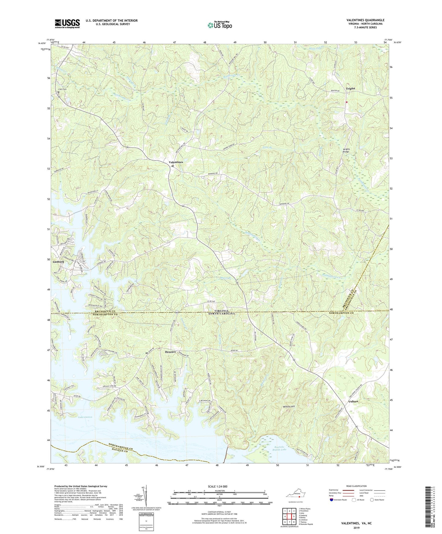
2019 topographic map quadrangle Valentines in the states of Virginia, North Carolina. Scale: 1:24000. Based on the newly updated USGS 7.5' US Topo map series, this map is in the following counties: Brunswick, Northampton, Greensville, Halifax. The map contains contour data, water features, and other items you are used to seeing on USGS maps, but also has updated roads and other features. This is the next generation of topographic maps. Printed on high-quality waterproof paper with UV fade-resistant inks.
Quads adjacent to this one:
West: Gasburg
Northwest: White Plains
North: Powellton
Northeast: Ante
East: Barley
Southeast: Roanoke Rapids
South: Thelma
Southwest: Littleton
Contains the following named places: Baker Island, Barnes Creek, Black Gut Creek, Bowens Corner, Brunswick Estates, Cabin Branch, Central Life Saving and Rescue Squad, Clary Cemetery, Clary Millpond, Cold Spring Branch, Colony Club, Delbridge Estates, Devils Branch, Drumgoole, Edwards Creek, First Cedar Grove Church, Gasburg Census Designated Place, Gaston Church, Gaston Dam, Gaston School, Henrico, Henrico Post Office, Hidden Acres, Houses Creek, Jimmies Creek, Kennons, Lake Gaston Estates, Little Bethel Church, Little Chapel Holiness Church, Little River, Long Branch, Mason Branch, Mason Grove Church, Pea Hill Creek, Pea Hill Estates, Pea Hill Shores, Poythress Estates, Saint Lukes Church, Scout Branch, Southside Shores, Triplet, Triplet Volunteer Fire Department, Valentines, Valentines Post Office, Valentines School Number Seven, Vultare, Wilkins Hill, Wrights Bridge, ZIP Codes: 23887, 27842