MyTopo
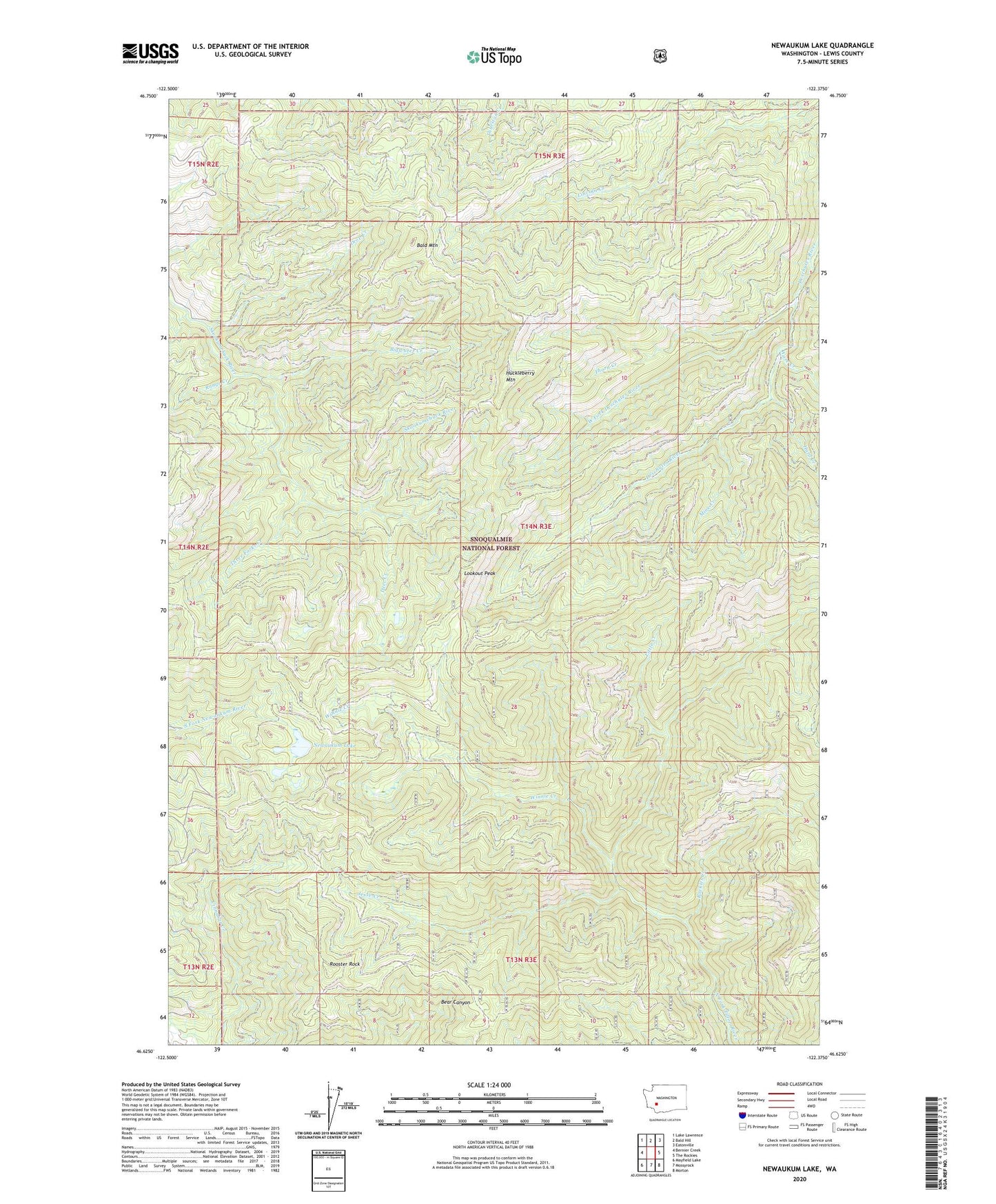
Newaukum Lake Washington US Topo Map
Couldn't load pickup availability
Also explore the Newaukum Lake Forest Service Topo of this same quad for updated USFS data
2023 topographic map quadrangle Newaukum Lake in the state of Washington. Scale: 1:24000. Based on the newly updated USGS 7.5' US Topo map series, this map is in the following counties: Lewis. The map contains contour data, water features, and other items you are used to seeing on USGS maps, but also has updated roads and other features. This is the next generation of topographic maps. Printed on high-quality waterproof paper with UV fade-resistant inks.
Quads adjacent to this one:
West: Bernier Creek
Northwest: Lake Lawrence
North: Bald Hill
Northeast: Eatonville
East: The Rockies
Southeast: Morton
South: Mossyrock
Southwest: Mayfield Lake
This map covers the same area as the classic USGS quad with code o46122f4.
Contains the following named places: Bald Mountain, Bigwater Creek, Deer Creek, Drop Creek, Hard Creek, Huckleberry Mountain, Huckleberry Mountain Lookout, Jesse Creek, KXXO-FM (Olympia), Little Creek, Lookout Peak, Mine Creek, Newaukum Lake, Newaukum Lookout, Range Creek, Rockies Creek, Rooster Rock, Thorn Creek, Three Forks Creek, Ware Creek, West Fork Deschutes River, Winnie Creek, ZIP Code: 98533