MyTopo
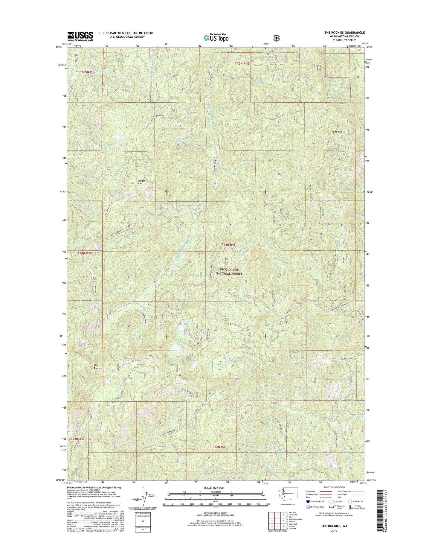
The Rockies Washington US Topo Map
Couldn't load pickup availability
Also explore the The Rockies Forest Service Topo of this same quad for updated USFS data
2023 topographic map quadrangle The Rockies in the state of Washington. Scale: 1:24000. Based on the newly updated USGS 7.5' US Topo map series, this map is in the following counties: Lewis. The map contains contour data, water features, and other items you are used to seeing on USGS maps, but also has updated roads and other features. This is the next generation of topographic maps. Printed on high-quality waterproof paper with UV fade-resistant inks.
Quads adjacent to this one:
West: Newaukum Lake
Northwest: Bald Hill
North: Eatonville
Northeast: Elbe
East: Mineral
Southeast: Glenoma
South: Morton
Southwest: Mossyrock
This map covers the same area as the classic USGS quad with code o46122f3.
Contains the following named places: Buck Creek, Cougar Mountain, Duck Lake, Eagle Creek, Fly Creek, Goose Lake, Hiawatha Creek, Ladd Lookout, Ladd Mountain, Lake Creek, Lewis Creek, Lincoln Creek, Mineral Division, Petite Lake, Scatter Creek, Soap Creek, Soos Creek, Spencer Creek, Stahl Mountain, The Rockies, Trap Creek, Trout Creek, West Fork Little Nisqually River, Wildcat Creek, Winston Creek