MyTopo
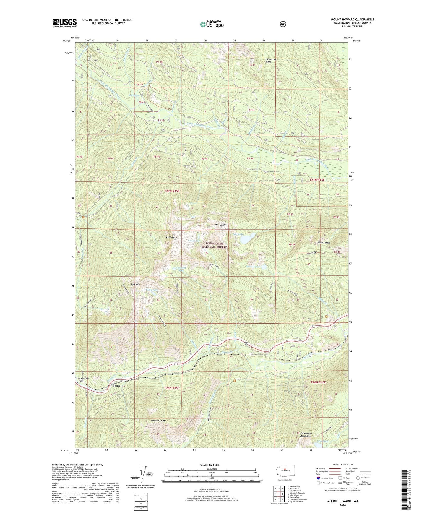
Mount Howard Washington US Topo Map
Couldn't load pickup availability
Also explore the Mount Howard Forest Service Topo of this same quad for updated USFS data
2023 topographic map quadrangle Mount Howard in the state of Washington. Scale: 1:24000. Based on the newly updated USGS 7.5' US Topo map series, this map is in the following counties: Chelan. The map contains contour data, water features, and other items you are used to seeing on USGS maps, but also has updated roads and other features. This is the next generation of topographic maps. Printed on high-quality waterproof paper with UV fade-resistant inks.
Quads adjacent to this one:
West: Labyrinth Mountain
Northwest: Poe Mountain
North: Mount David
Northeast: Schaefer Lake
East: Lake Wenatchee
Southeast: Big Jim Mountain
South: Chiwaukum Mountains
Southwest: Stevens Pass
This map covers the same area as the classic USGS quad with code o47120g8.
Contains the following named places: Arrowhead Mountain, Berne, Canan Lake, Cascade Meadows Church Camp, Cedar Creek, Crescent Creek, Crescent Lake, Fir Creek, Fir Creek Recreation Area, Gaynor, Henry Creek, Hidden Creek, Lake Ethel, Line Creek, Lost Creek, Lost Lake, Mahar Creek, Merritt Lake, Mount Howard, Mount Mastiff, Nason Ridge, Ninemile Creek, Peavine Creek, Rainy Creek, Riverside Campground, Rock Lake, Rock Mountain, Royal Creek, Schilling Creek, Snowy Creek, Soda Creek, Soda Spring, Soda Springs Campground, Whitepine Creek