MyTopo
Chiwaukum Mountains Washington US Topo Map
Couldn't load pickup availability
Also explore the Chiwaukum Mountains Forest Service Topo of this same quad for updated USFS data
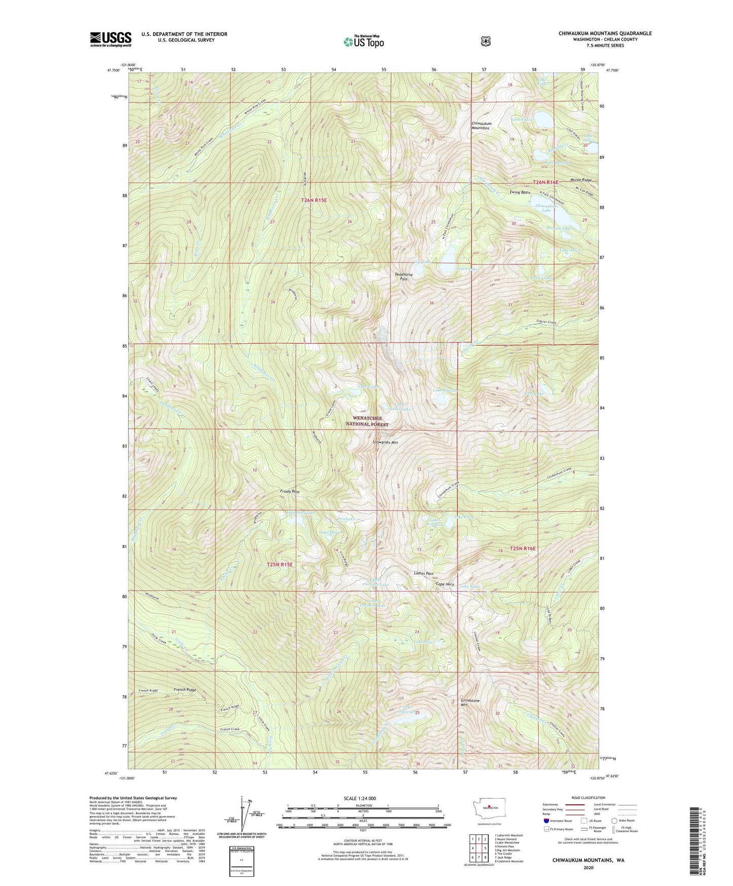
2023 topographic map quadrangle Chiwaukum Mountains in the state of Washington. Scale: 1:24000. Based on the newly updated USGS 7.5' US Topo map series, this map is in the following counties: Chelan. The map contains contour data, water features, and other items you are used to seeing on USGS maps, but also has updated roads and other features. This is the next generation of topographic maps. Printed on high-quality waterproof paper with UV fade-resistant inks.
Quads adjacent to this one:
West: Stevens Pass
Northwest: Labyrinth Mountain
North: Mount Howard
Northeast: Lake Wenatchee
East: Big Jim Mountain
Southeast: Cashmere Mountain
South: Jack Ridge
Southwest: The Cradle
This map covers the same area as the classic USGS quad with code o47120f8.
Contains the following named places: Brule Creek, Cape Horn, Chiwaukum Lake, Chiwaukum Mountains, Cup Lake, Deadhorse Pass, Ewing Basin, French Creek, French Creek Campground, Frosty Creek, Frosty Pass, Grindstone Mountain, Honour Lake, Jason Lakes, Knox Lake, Ladies Pass, Lake Alice, Lake Brigham, Lake Charles, Lake Donald, Lake Edna, Lake Flore, Lake Grace, Lake Jason, Lake Julius, Lake Margaret, Lake Mary, Lake Sylvester, Larch Lake, Loch Eileen, Lower Florence Lake, Mccue Ridge, Packrat Camp, Snowgrass Mountain, Spanish Camp Creek, Upper Florence Lake, Upper Grace Lake, Wildhorse Creek