MyTopo
Blanca Lake Washington US Topo Map
Couldn't load pickup availability
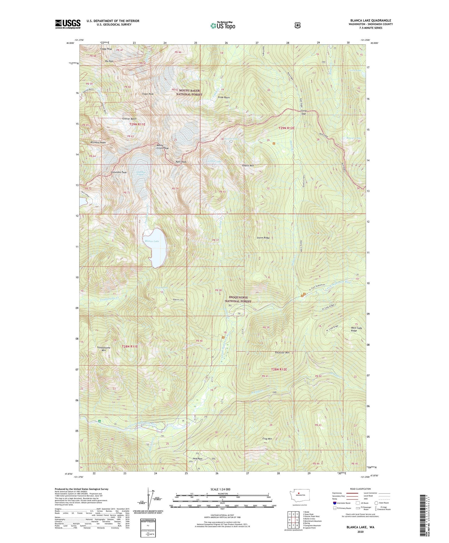
2020 topographic map quadrangle Blanca Lake in the state of Washington. Scale: 1:24000. Based on the newly updated USGS 7.5' US Topo map series, this map is in the following counties: Snohomish. The map contains contour data, water features, and other items you are used to seeing on USGS maps, but also has updated roads and other features. This is the next generation of topographic maps. Printed on high-quality waterproof paper with UV fade-resistant inks.
Quads adjacent to this one:
West: Monte Cristo
Northwest: Bedal
North: Sloan Peak
Northeast: Glacier Peak West
East: Benchmark Mountain
Southeast: Captain Point
South: Evergreen Mountain
Southwest: Baring
Contains the following named places: Bald Eagle Mountain, Blanca Lake, Bowser Lake, Cadet Peak, Columbia Glacier, Columbia Peak, Coney Lake, Curry Gap, Excelsior Mountain, Foggy Peak, Frog Mountain, Garland Mineral Springs, Glacier Basin, Goblin Creek, Goblin Lake, Goblin Mountain, Ida Pass, Jack Pass, Kyes Peak, Monte Cristo Peak, Mystery Hill, Pride Basin, Quartz Creek, Quartz Lake, San Juan Campground, San Juan Creek, Storm Ridge, Troublesome Mountain, Virgin Lake, West Cady Creek, Wilmans Peaks