MyTopo
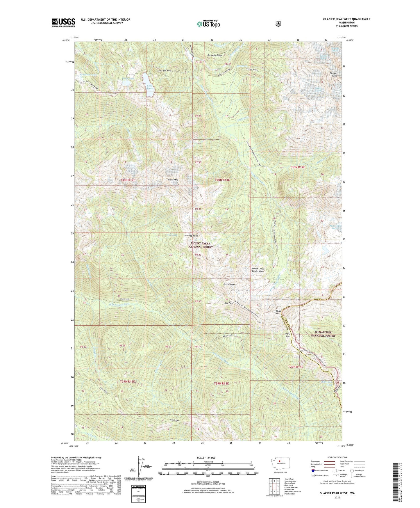
Glacier Peak West Washington US Topo Map
Couldn't load pickup availability
Also explore the Glacier Peak West Forest Service Topo of this same quad for updated USFS data
2023 topographic map quadrangle Glacier Peak West in the state of Washington. Scale: 1:24000. Based on the newly updated USGS 7.5' US Topo map series, this map is in the following counties: Snohomish, Chelan. The map contains contour data, water features, and other items you are used to seeing on USGS maps, but also has updated roads and other features. This is the next generation of topographic maps. Printed on high-quality waterproof paper with UV fade-resistant inks.
Quads adjacent to this one:
West: Sloan Peak
Northwest: Mount Pugh
North: Lime Mountain
Northeast: Gamma Peak
East: Glacier Peak East
Southeast: Poe Mountain
South: Benchmark Mountain
Southwest: Blanca Lake
This map covers the same area as the classic USGS quad with code o48121a2.
Contains the following named places: Baekos Creek, Black Mountain, Camp Lake, Chetwot Creek, Chikamin Creek, Glacier Peak Shelter, Hardtack Lake, Kennedy Creek, Kennedy Hot Spring, Kennedy Hot Springs, Kid Pond, Lake Byrne, Mackinaw Shelter, Portal Peak, Red Creek, Red Pass, Reflection Pond, Scimitar Glacier, Sitkum Creek, Sitkum Glacier, Skalabats Creek, Skullcap Peak, Tahlak Creek, Van Lake, White Chuck Cinder Cone, White Mountain, White Pass