MyTopo
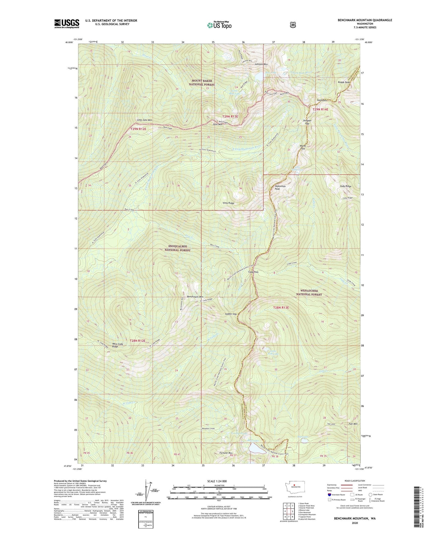
Benchmark Mountain Washington US Topo Map
Couldn't load pickup availability
Also explore the Benchmark Mountain Forest Service Topo of this same quad for updated USFS data
2023 topographic map quadrangle Benchmark Mountain in the state of Washington. Scale: 1:24000. Based on the newly updated USGS 7.5' US Topo map series, this map is in the following counties: Snohomish, Chelan. The map contains contour data, water features, and other items you are used to seeing on USGS maps, but also has updated roads and other features. This is the next generation of topographic maps. Printed on high-quality waterproof paper with UV fade-resistant inks.
Quads adjacent to this one:
West: Blanca Lake
Northwest: Sloan Peak
North: Glacier Peak West
Northeast: Glacier Peak East
East: Poe Mountain
Southeast: Labyrinth Mountain
South: Captain Point
Southwest: Evergreen Mountain
This map covers the same area as the classic USGS quad with code o47121h2.
Contains the following named places: Benchmark Mountain, Benchmark Mountain Lookout, Blue Lake, Blue Lake Shelter, Cady Pass, Cady Ridge, Dishpan Gap, Fall Mountain, Fortune Mountain, Fortune Ponds, Henry M Jackson Wilderness, Johnson Mountain, June Mountain, Kodak Peak, Lake Sally Ann, Little Blue Lake, Little Fish Lake, Long John Mountain, Pass Creek, Pear Lake, Saddle Gap, Sauk Pass, Skykomish Peak, Top Lake, Vimy Ridge, Wards Pass, West Cady Ridge