MyTopo
Monte Cristo Washington US Topo Map
Couldn't load pickup availability
Also explore the Monte Cristo Forest Service Topo of this same quad for updated USFS data
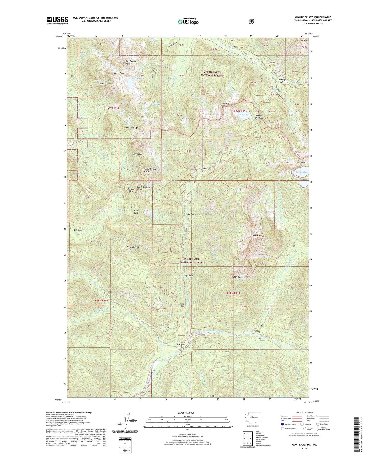
2023 topographic map quadrangle Monte Cristo in the state of Washington. Scale: 1:24000. Based on the newly updated USGS 7.5' US Topo map series, this map is in the following counties: Snohomish. The map contains contour data, water features, and other items you are used to seeing on USGS maps, but also has updated roads and other features. This is the next generation of topographic maps. Printed on high-quality waterproof paper with UV fade-resistant inks.
Quads adjacent to this one:
West: Mount Stickney
Northwest: Silverton
North: Bedal
Northeast: Sloan Peak
East: Blanca Lake
Southeast: Evergreen Mountain
South: Baring
Southwest: Index
This map covers the same area as the classic USGS quad with code o47121h4.
Contains the following named places: Bear Creek, Big Gulch, Canyon Creek, Crested Buttes, Del Campo Peak, Foggy Lake, Foggy Pass, Galena, Glacier Creek, Gothic Peak, Gulch Lakes, Hard Pass, Hops Hill Campground, Howard Creek, Hubbart Peak, Lake Gulch, Lost Creek, Mineral Butte, Mineral City, Monte Cristo, Monte Cristo Campground, North Crested Butte, Poodle Dog Pass, Quartz Creek, Red Gulch, Salmon Creek, Sauk River Campground, Scott Peak, Seventysix Gulch, Sheep Gap, Sheep Gap Mountain, Silver Creek, Silver Lake, Silvertip Campground, Silvertip Creek, Silvertip Peak, South Crested Butte, South Fork Salmon Creek, Sultan Division, Sunday Falls, Troublesome Creek, Troublesome Creek Campground, Twin Lakes, Twin Peaks, Weeden Lake, West Fork Troublesome Creek