MyTopo
Labyrinth Mountain Washington US Topo Map
Couldn't load pickup availability
Also explore the Labyrinth Mountain Forest Service Topo of this same quad for updated USFS data
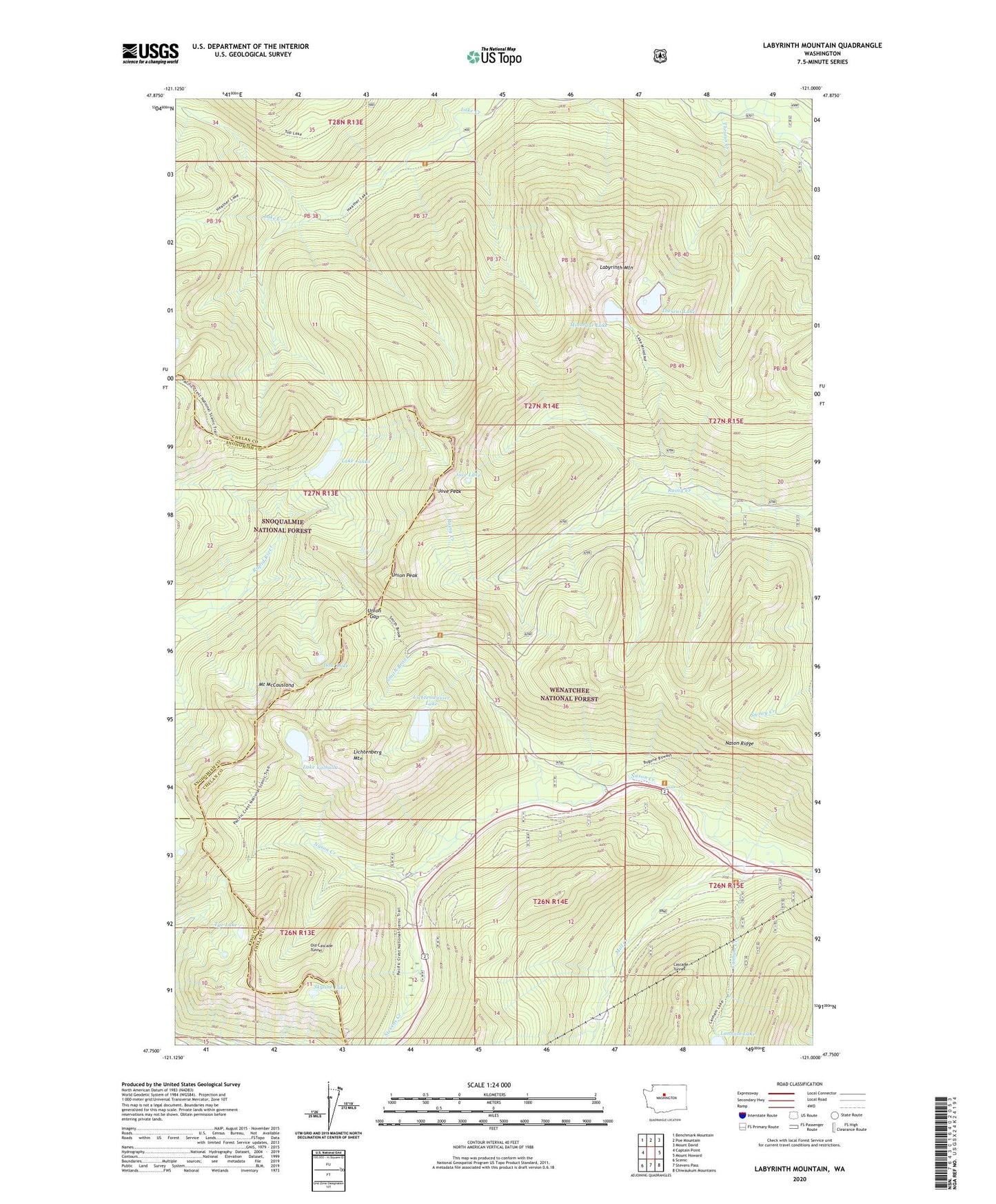
2023 topographic map quadrangle Labyrinth Mountain in the state of Washington. Scale: 1:24000. Based on the newly updated USGS 7.5' US Topo map series, this map is in the following counties: Chelan, Snohomish, King. The map contains contour data, water features, and other items you are used to seeing on USGS maps, but also has updated roads and other features. This is the next generation of topographic maps. Printed on high-quality waterproof paper with UV fade-resistant inks.
Quads adjacent to this one:
West: Captain Point
Northwest: Benchmark Mountain
North: Poe Mountain
Northeast: Mount David
East: Mount Howard
Southeast: Chiwaukum Mountains
South: Stevens Pass
Southwest: Scenic
This map covers the same area as the classic USGS quad with code o47121g1.
Contains the following named places: Devils Club Creek, Dow Lake, Elevenmile Creek, Jove Lake, Jove Peak, Labyrinth Mountain, Lake Janus, Lake Valhalla, Lanham Creek, Lanham Lake, Lichtenberg Mountain, Lichtenwasser Lake, Lodgepole Creek, Mill Creek, Minotaur Lake, Mount McCausland, Old Cascade Tunnel, Skyline Lake, Smith Brook, Stevens Creek, Theseus Creek, Theseus Creek Campground, Theseus Lake, Totem Girl Scout Org Camp, Tye Lake, Union Gap, Union Peak