MyTopo
Stevens Pass Washington US Topo Map
Couldn't load pickup availability
Also explore the Stevens Pass Forest Service Topo of this same quad for updated USFS data
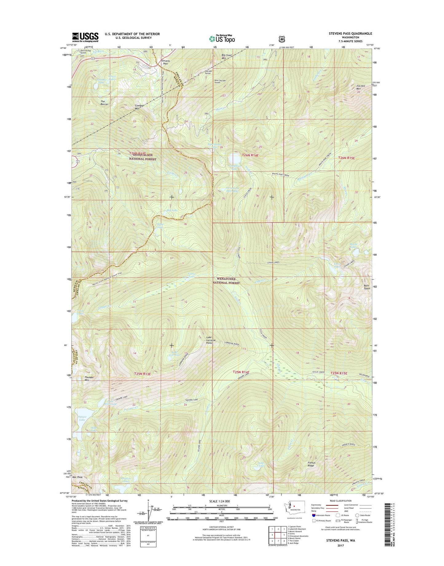
2023 topographic map quadrangle Stevens Pass in the state of Washington. Scale: 1:24000. Based on the newly updated USGS 7.5' US Topo map series, this map is in the following counties: Chelan, King. The map contains contour data, water features, and other items you are used to seeing on USGS maps, but also has updated roads and other features. This is the next generation of topographic maps. Printed on high-quality waterproof paper with UV fade-resistant inks.
Quads adjacent to this one:
West: Scenic
Northwest: Captain Point
North: Labyrinth Mountain
Northeast: Mount Howard
East: Chiwaukum Mountains
Southeast: Jack Ridge
South: The Cradle
Southwest: Mount Daniel
This map covers the same area as the classic USGS quad with code o47121f1.
Contains the following named places: Bark Cabin, Basin Creek, Big Chief Mountain, Bulls Tooth, Cascade Tunnel, Chain Creek, Chain Lakes, Cowboy Mountain, Cuitin Creek, Doelle Lakes, Doughgod Creek, Grace Lakes, Grass Lake, Hope Lake, Jim Hill Mountain, Josephine Lake, Lake Cuitin, Lake Lorraine, Lake Lorraine Point, Lake Susan Jane, Lake Wolverine, Leland Creek, Mac Peak, Mig Lake, Milk Lake, Mule Creek, New Cascade Tunnel, Pacific Crest Trailhead, Prospect Creek, Square Lake, Square Lake Dam, Steven Pass Org Site, Stevens Pass, Stevens Pass Guard Station, Stevens Pass Recreation Area, Summit Lake, Swallow Lakes, Swimming Deer Lake, The Barrier, Thunder Mountain Lakes, Trap Lake, Trapper Creek, Tye