MyTopo
Elbe Washington US Topo Map
Couldn't load pickup availability
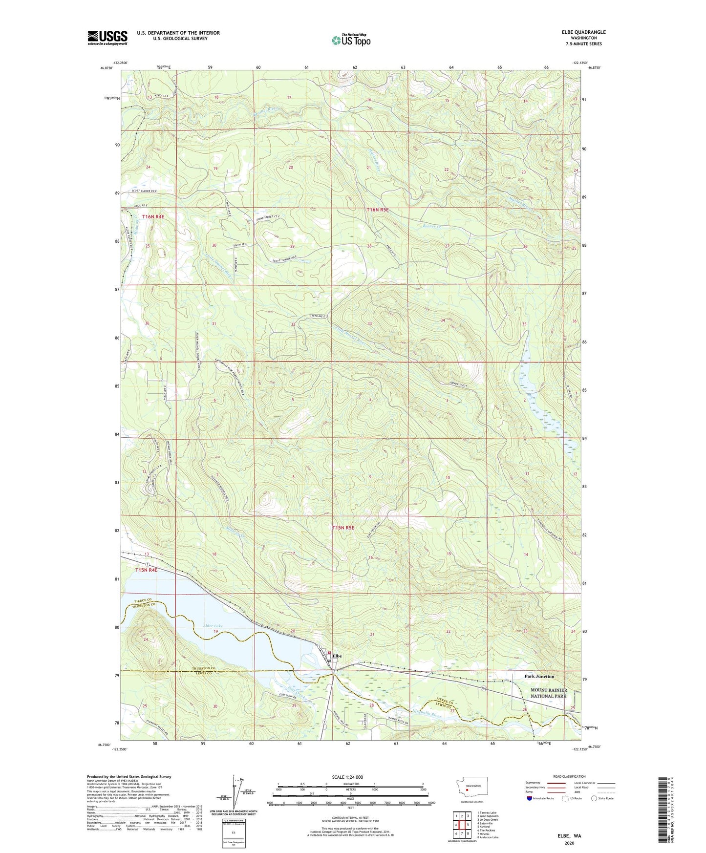
2020 topographic map quadrangle Elbe in the state of Washington. Scale: 1:24000. Based on the newly updated USGS 7.5' US Topo map series, this map is in the following counties: Pierce, Lewis, Thurston. The map contains contour data, water features, and other items you are used to seeing on USGS maps, but also has updated roads and other features. This is the next generation of topographic maps. Printed on high-quality waterproof paper with UV fade-resistant inks.
Quads adjacent to this one:
West: Eatonville
Northwest: Tanwax Lake
North: Lake Kapowsin
Northeast: Le Dout Creek
East: Ashford
Southeast: Anderson Lake
South: Mineral
Southwest: The Rockies
Contains the following named places: Alder Lake, Beaver Creek, Dobbs Mountain, East Creek, Eatonville Division, Elbe, Elbe Census Designated Place, Elbe Post Office, Midway Creek, Mineral Creek, Park Junction, Pierce County Fire District 23 Station 2, ZIP Codes: 98328, 98330