MyTopo
Forbidden Peak Washington US Topo Map
Couldn't load pickup availability
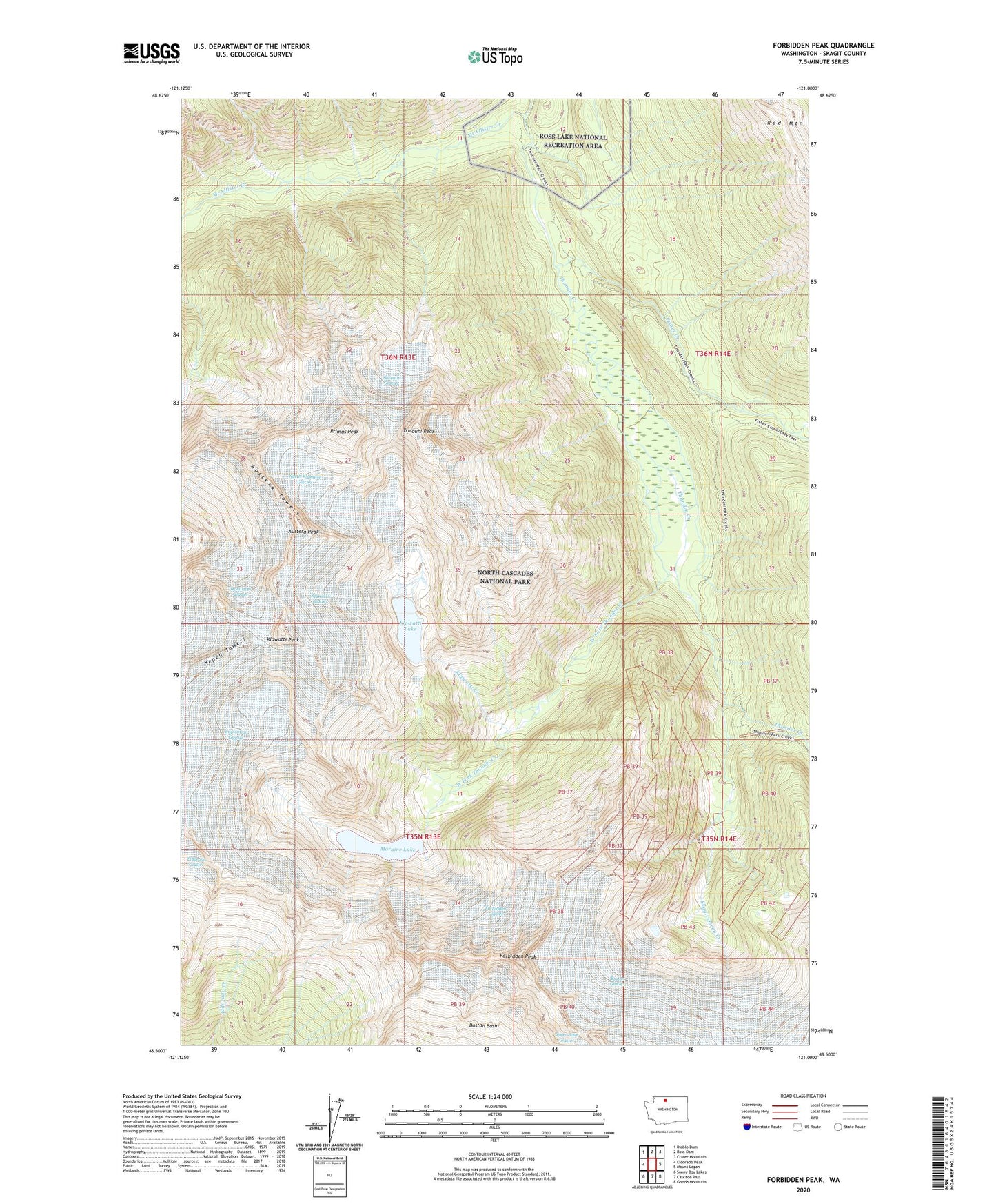
2020 topographic map quadrangle Forbidden Peak in the state of Washington. Scale: 1:24000. Based on the newly updated USGS 7.5' US Topo map series, this map is in the following counties: Skagit. The map contains contour data, water features, and other items you are used to seeing on USGS maps, but also has updated roads and other features. This is the next generation of topographic maps. Printed on high-quality waterproof paper with UV fade-resistant inks.
Quads adjacent to this one:
West: Eldorado Peak
Northwest: Diablo Dam
North: Ross Dam
Northeast: Crater Mountain
East: Mount Logan
Southeast: Goode Mountain
South: Cascade Pass
Southwest: Sonny Boy Lakes
Contains the following named places: Austera Peak, Austera Towers, Borealis Glacier, Boston Basin, Boston Glacier, Fisher Creek, Forbidden Glacier, Forbidden Peak, Inspiration Glacier, Klawatti Creek, Klawatti Glacier, Klawatti Lake, Klawatti Peak, McAllister Creek, McAllister Glacier, Meadow Cabins, Moraine Lake, Mount Torment, North Klawatti Glacier, Primus Peak, Skagit Queen Creek, Skagit Queen Mine, Tricouni Peak, West Fork Thunder Creek