MyTopo
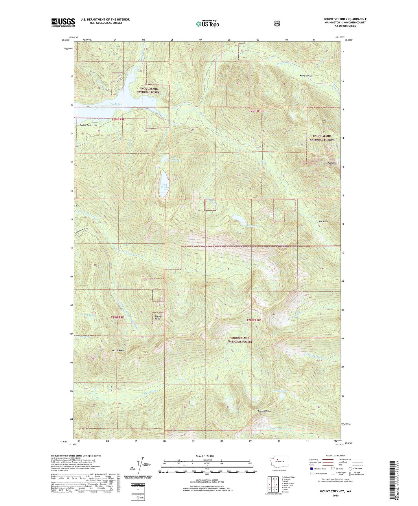
Mount Stickney Washington US Topo Map
Couldn't load pickup availability
Also explore the Mount Stickney Forest Service Topo of this same quad for updated USFS data
2023 topographic map quadrangle Mount Stickney in the state of Washington. Scale: 1:24000. Based on the newly updated USGS 7.5' US Topo map series, this map is in the following counties: Snohomish. The map contains contour data, water features, and other items you are used to seeing on USGS maps, but also has updated roads and other features. This is the next generation of topographic maps. Printed on high-quality waterproof paper with UV fade-resistant inks.
Quads adjacent to this one:
West: Wallace Lake
Northwest: Mallardy Ridge
North: Silverton
Northeast: Bedal
East: Monte Cristo
Southeast: Baring
South: Index
Southwest: Gold Bar
This map covers the same area as the classic USGS quad with code o47121h5.
Contains the following named places: Bear Creek, Big Greider Lake, Boulder Creek, Boulder Lake, Elk Basin, Elk Creek, Gilbert Creek, Greider Creek, Kelly Creek, Kromona Mine, Little Greider Lake, McCarty Creek, Middle Fork South Fork Sultan River, Mount Stickney, North Fork South Fork Sultan River, One Acre Lake, Prospect Peak, Rainy Gulch, Red Mountain, Rose Lake, Snowfall Lake, South Fork South Fork Sultan River, Vesper Creek, Williamson Creek, ZIP Code: 98251