MyTopo
Gold Mountain Washington US Topo Map
Couldn't load pickup availability
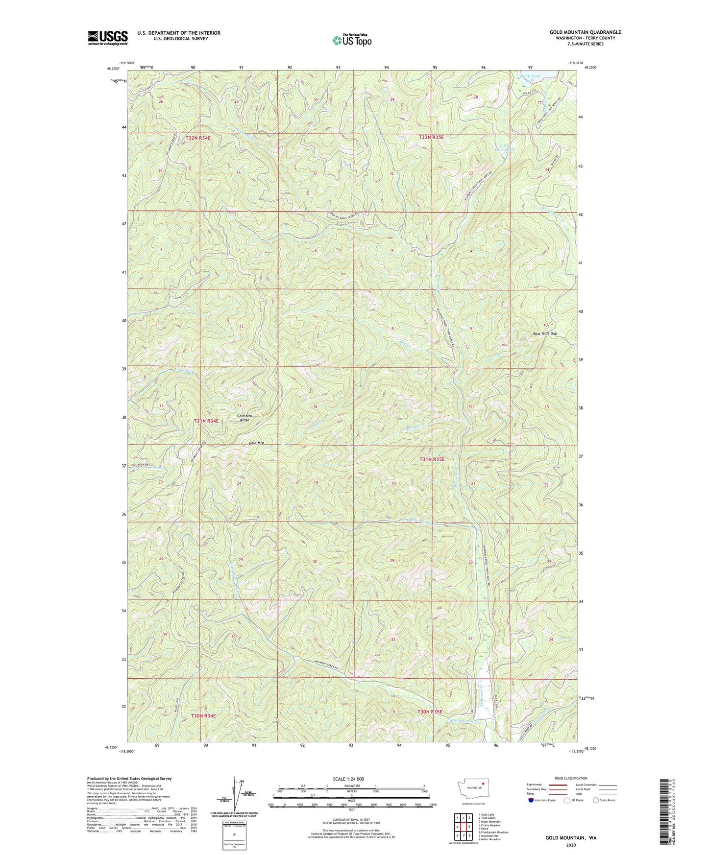
2023 topographic map quadrangle Gold Mountain in the state of Washington. Scale: 1:24000. Based on the newly updated USGS 7.5' US Topo map series, this map is in the following counties: Ferry. The map contains contour data, water features, and other items you are used to seeing on USGS maps, but also has updated roads and other features. This is the next generation of topographic maps. Printed on high-quality waterproof paper with UV fade-resistant inks.
Quads adjacent to this one:
West: Frosty Meadow
Northwest: Cody Lake
North: Twin Lakes
Northeast: Moon Mountain
East: Kewa
Southeast: Miller Mountain
South: Ninemile Flat
Southwest: Friedlander Meadows
This map covers the same area as the classic USGS quad with code o48118b4.
Contains the following named places: Bear Hide Gap, Dry Creek, Gold Mountain, Gold Mountain Lookout, Gold Mountain Ridge, Little Twin Lakes, Little Wilmont Creek, Rock Creek, Sucker Creek, Tepee Creek, Three Forks Creek, ZIP Code: 99138