MyTopo
Harlow Ridge Washington US Topo Map
Couldn't load pickup availability
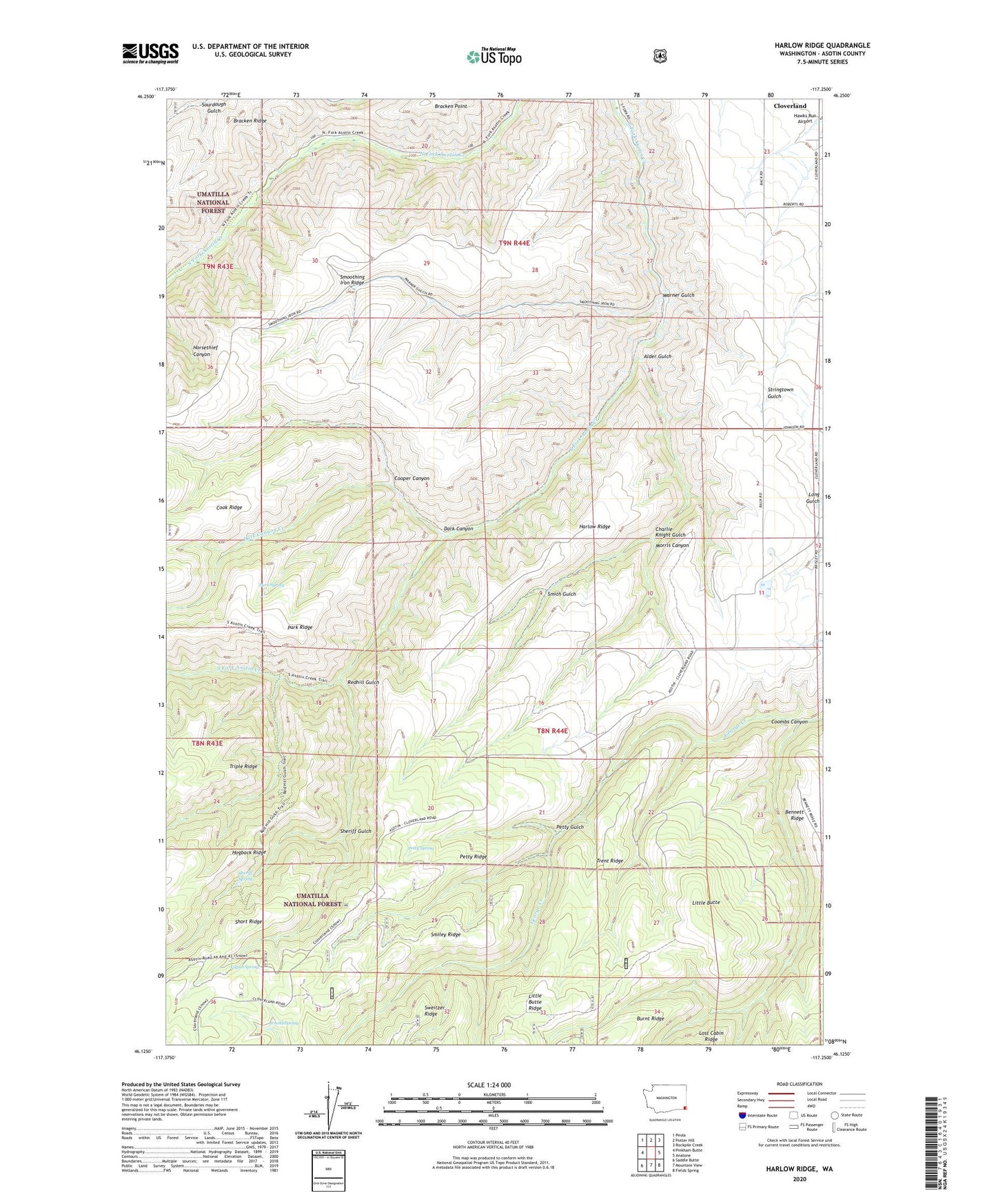
2020 topographic map quadrangle Harlow Ridge in the state of Washington. Scale: 1:24000. Based on the newly updated USGS 7.5' US Topo map series, this map is in the following counties: Asotin. The map contains contour data, water features, and other items you are used to seeing on USGS maps, but also has updated roads and other features. This is the next generation of topographic maps. Printed on high-quality waterproof paper with UV fade-resistant inks.
Quads adjacent to this one:
West: Pinkham Butte
Northwest: Peola
North: Potter Hill
Northeast: Rockpile Creek
East: Anatone
Southeast: Fields Spring
South: Mountain View
Southwest: Saddle Butte
Contains the following named places: Alder Gulch, Arnold Spring, Arthur Weiss Ranch, Black Ranch, Charlie Knight Gulch, Charlie Knight Ranch, Coombs Canyon, Cooper Canyon, Dark Canyon, Dark Canyon Creek, E A Parsons Ranch, Harlow Ridge, Jim Barkley Ranch, Little Butte, Morris Canyon, Park Spring, Petty Gulch, Petty Ridge, Petty Spring, Raymond Blankenship Ranch, Red Hill Gulch Trail, Redhill Gulch, Sheriff Gulch, Sheriff Spring, Smiley Ridge, Smith Gulch, South Asotin Trail, Trent Ridge, Vogan Spring, Warner Gulch