MyTopo
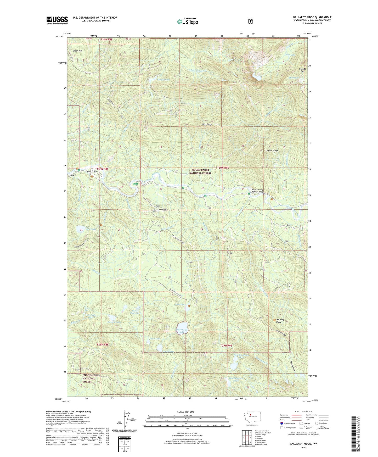
Mallardy Ridge Washington US Topo Map
Couldn't load pickup availability
Also explore the Mallardy Ridge Forest Service Topo of this same quad for updated USFS data
2023 topographic map quadrangle Mallardy Ridge in the state of Washington. Scale: 1:24000. Based on the newly updated USGS 7.5' US Topo map series, this map is in the following counties: Snohomish. The map contains contour data, water features, and other items you are used to seeing on USGS maps, but also has updated roads and other features. This is the next generation of topographic maps. Printed on high-quality waterproof paper with UV fade-resistant inks.
Quads adjacent to this one:
West: Verlot
Northwest: Meadow Mountain
North: Whitehorse Mountain
Northeast: Helena Ridge
East: Silverton
Southeast: Mount Stickney
South: Wallace Lake
Southwest: Lake Chaplain
This map covers the same area as the classic USGS quad with code o48121a6.
Contains the following named places: Ashland Lakes, Bald Mountain Lake, Bear Creek, Bear Lake, Beaver Plant Lake, Black Creek, Blackjack Creek, Boardman Creek, Boardman Creek Camp, Boardman Lake, Bolt Camp, Canyon Lake, Clear Lake, Cutthroat Lakes, East Boardman Lake, Eldredge Creek, Gold Basin, Gold Basin Campground, Gold Basin Recreation Area, Gordon Creek, Gordon Ridge, Granite Pass, Green Mountain, Hempel Creek, Hemple Creek Campground, Island Lake, Lake Evan, Long Creek, Long Creek Research Natural Area, Lost Lake, Mallardy Creek, Mallardy Ridge, Mountain Loop Highway Bridge, Red Bridge Campground, River Bar Campground, Sawyer Camp, Schweitzer Creek, Slide Camp, Snohomish County, Sunnyside Camp, Tulalip Mill Site, Twin Falls, Twin Falls Lake, Wiley Creek, Wiley Creek Camp, Wiley Ridge, Wisconsin Creek, Youth-on-Age, ZIP Code: 98252