
MyTopo
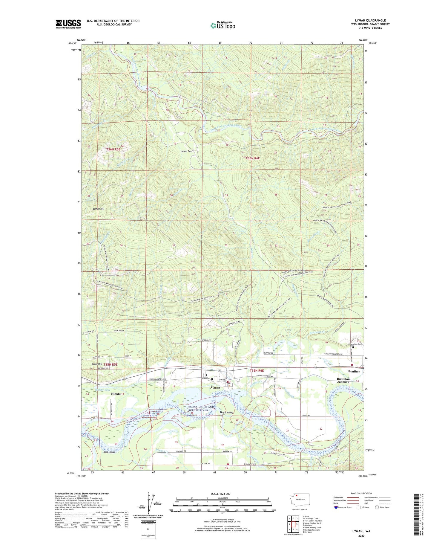
Lyman Washington US Topo Map
Couldn't load pickup availability
2020 topographic map quadrangle Lyman in the state of Washington. Scale: 1:24000. Based on the newly updated USGS 7.5' US Topo map series, this map is in the following counties: Skagit. The map contains contour data, water features, and other items you are used to seeing on USGS maps, but also has updated roads and other features. This is the next generation of topographic maps. Printed on high-quality waterproof paper with UV fade-resistant inks.
Quads adjacent to this one:
West: Sedro-Woolley North
Northwest: Acme
North: Cavanaugh Creek
Northeast: Twin Sisters Mountain
East: Hamilton
Southeast: Day Lake
South: Haystack Mountain
Southwest: Sedro-Woolley South
Contains the following named places: Bacus Hill, Branshel Farm, Camp Eighteen, Canyon Creek, Childs Creek, Davis Slough, Day Creek, Day Creek Chapel, Deer Creek, Fobes Creek, Hamilton Cemetery, Hamilton Junction, Israel's Farm Airport, Jims Slough, Jones Creek, Loretta Creek, Lyman, Lyman Cemetery, Lyman Elementary School, Lyman Ferry, Lyman Pass, Lyman Post Office, Mannser Creek, Minkler, Minkler Lake, Morgan Creek, Muddy Creek, Plumbago Creek, Red Cabin Creek, Roaring Creek, Ross Island, Skagit County Fire District 16 Day Creek Fire Department, Skagit County Fire District 8 Lyman, Skagit County Fire District 8 Punkin Center, Sundstrom Dairy, Tingley School, Town of Lyman, ZIP Code: 98263


