
MyTopo
Old Baldy Mountain Washington US Topo Map
Couldn't load pickup availability
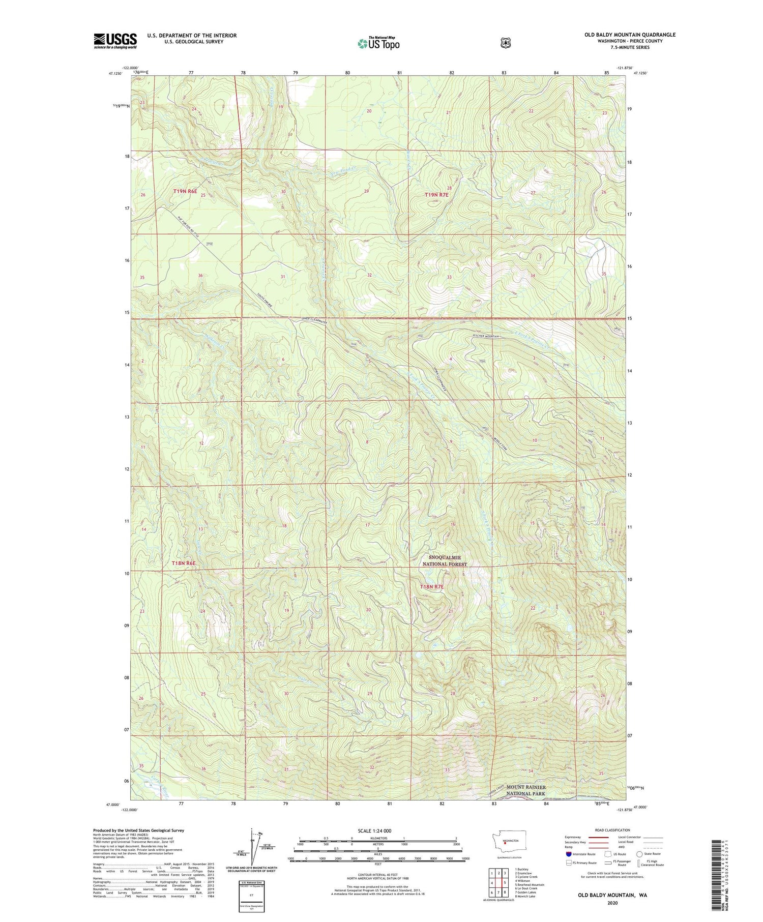
2020 topographic map quadrangle Old Baldy Mountain in the state of Washington. Scale: 1:24000. Based on the newly updated USGS 7.5' US Topo map series, this map is in the following counties: Pierce. The map contains contour data, water features, and other items you are used to seeing on USGS maps, but also has updated roads and other features. This is the next generation of topographic maps. Printed on high-quality waterproof paper with UV fade-resistant inks.
Quads adjacent to this one:
West: Wilkeson
Northwest: Buckley
North: Enumclaw
Northeast: Cyclone Creek
East: Bearhead Mountain
Southeast: Mowich Lake
South: Golden Lakes
Southwest: Le Dout Creek
Contains the following named places: Beaver Creek, Burnt Mountain, Carbon Ridge, East Fork South Prairie Creek, KBRD-FM (Tacoma), KWNT-AM (Buckley), New Pond Creek, O'Farrell Lookout, Old Baldy Mountain, South Fork Gale Creek, South Fork South Prairie Creek, South Prairie Lookout


