MyTopo
Skookum Creek Washington US Topo Map
Couldn't load pickup availability
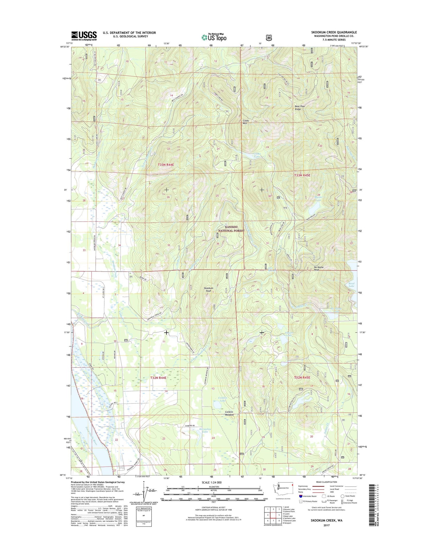
2020 topographic map quadrangle Skookum Creek in the state of Washington. Scale: 1:24000. Based on the newly updated USGS 7.5' US Topo map series, this map is in the following counties: Pend Oreille. The map contains contour data, water features, and other items you are used to seeing on USGS maps, but also has updated roads and other features. This is the next generation of topographic maps. Printed on high-quality waterproof paper with UV fade-resistant inks.
Quads adjacent to this one:
West: Cusick
Northwest: Jared
North: Browns Lake
Northeast: Galena Point
East: Bead Lake
Southeast: Newport
South: Diamond Lake
Southwest: Sacheen Lake
Contains the following named places: Bear Paw Ridge, Conklin Lake, Conklin Meadow, Cooks Creek, Cooks Lake, Cooks Mountain, Deer Springs, Hermann Pit, Horseshoe Lake, Iron Mount Talus Quarry, Little Skookum Creek, Mystic Lake, No Name Lake, No Name Lake Campground, No Name Lake Recreational Site, No Name Peak, North Fork Skookum Creek, Sandwich Creek, Skookum Community Center, Skookum Peak, South Fork Skookum Creek, Vances Lake