MyTopo
Hauer Wisconsin US Topo Map
Couldn't load pickup availability
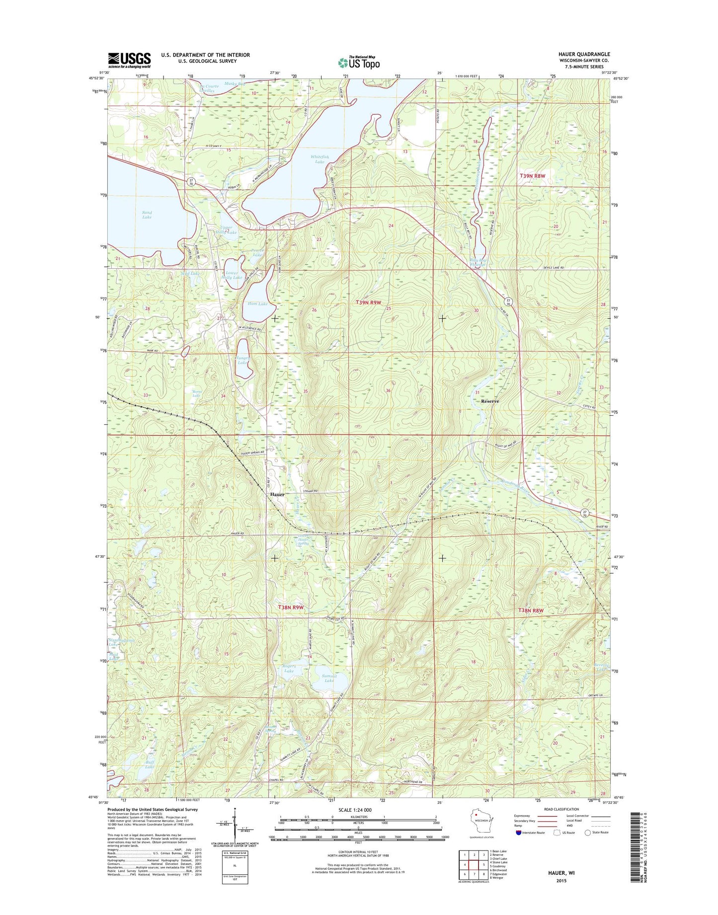
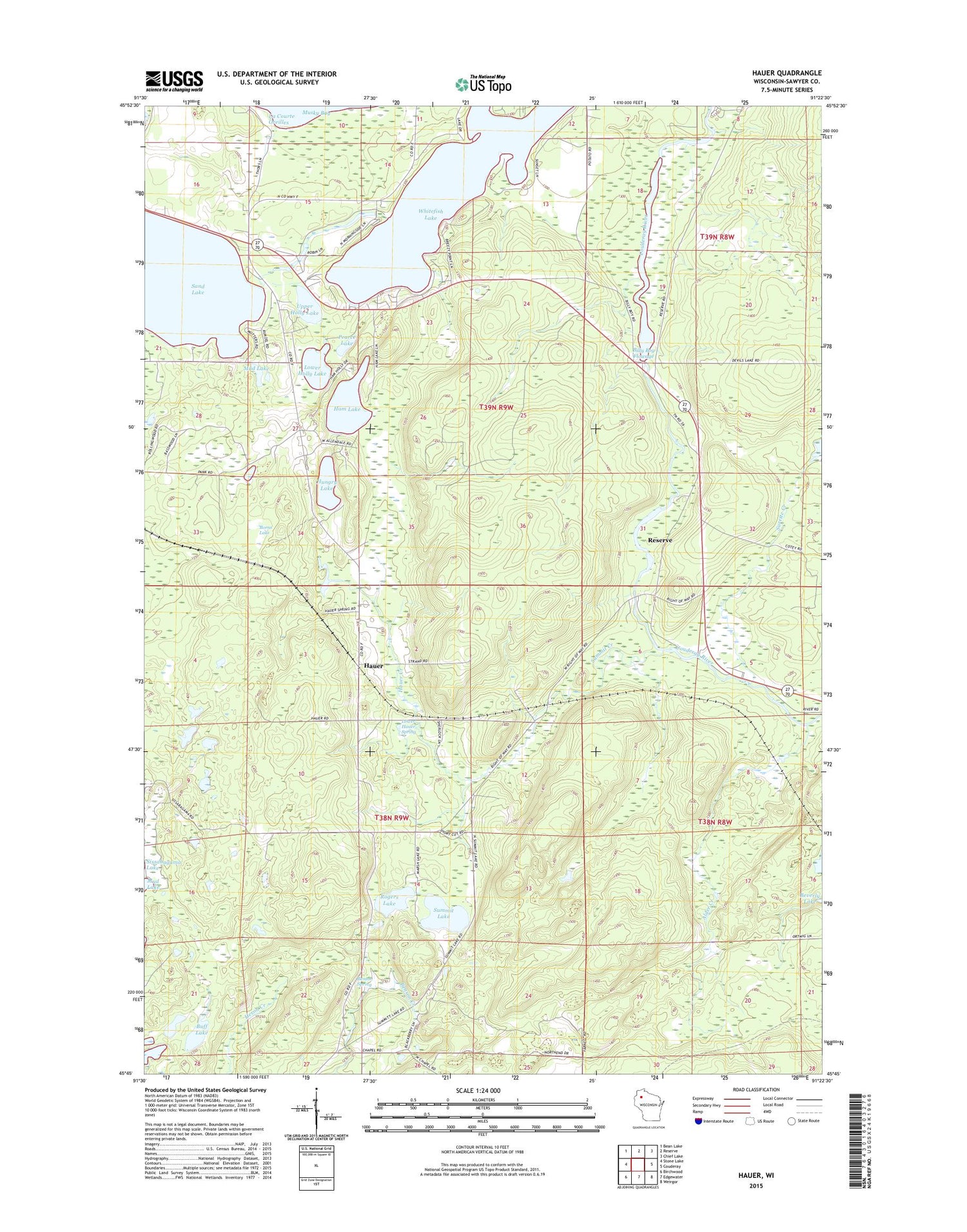
2018 topographic map quadrangle Hauer in the state of Wisconsin. Scale: 1:24000. Based on the newly updated USGS 7.5' US Topo map series, this map is in the following counties: Sawyer. The map contains contour data, water features, and other items you are used to seeing on USGS maps, but also has updated roads and other features. This is the next generation of topographic maps. Printed on high-quality waterproof paper with UV fade-resistant inks.
Quads adjacent to this one:
West: Stone Lake
Northwest: Bean Lake
North: Reserve
Northeast: Chief Lake
East: Couderay
Southeast: Weirgor
South: Edgewater
Southwest: Birchwood
Contains the following named places: Alder Creek, Benson Creek State Wildlife Management Area, Benson Spring, Billy Boy Dam, Billy Boy Flowage, Borns Lake, Buff Lake, Enbridge Energy-Pipeline Station, Ham Lake, Hauer, Hauer Creek, Hauer School, Hauer Springs State Wildlife Management Area, Hungry Lake, Lac Courte Oreilles State Wildlife Management Area, Lower Hauer Spring, Lower Holly Lake, Mud Lake, Pearce Lake, Rogers Lake, Sand Creek, Sand Lake, Sand Lake 22, Sand Lake 2WP826 Dam, Sand Lake Lookout Tower, Summit Creek, Summit Lake, Surette Creek, Town of Sand Lake, Upper Holly Lake, Wayside Chapel, Whitefish Lake, ZIP Code: 54876