
MyTopo
Jonesdale Wisconsin US Topo Map
Couldn't load pickup availability
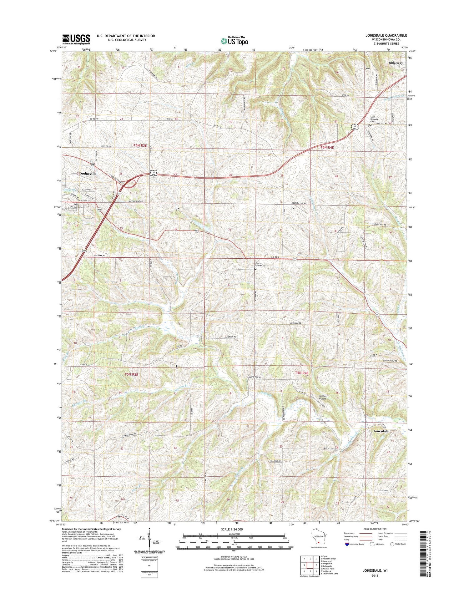
2018 topographic map quadrangle Jonesdale in the state of Wisconsin. Scale: 1:24000. Based on the newly updated USGS 7.5' US Topo map series, this map is in the following counties: Iowa. The map contains contour data, water features, and other items you are used to seeing on USGS maps, but also has updated roads and other features. This is the next generation of topographic maps. Printed on high-quality waterproof paper with UV fade-resistant inks.
Quads adjacent to this one:
West: Dodgeville
Northwest: Clyde
North: Pleasant Ridge
Northeast: Barneveld
East: Hollandale
Southeast: Yellowstone Lake
South: Waldwick
Southwest: Mineral Point
Contains the following named places: Blotz Branch, Dodgeville Wastewater Treatment Plant, East Side Cemetery, Garrison Grove Cemetery, Gribble Branch, Hollyhead School, Iowa County Quarry, Jonesdale, Ley Creek, Lynch Branch, Saint Bridget's Cemetery, Simmons Branch, Simpson Chapel, Tuschen Airport


