MyTopo
Lunds Wisconsin US Topo Map
Couldn't load pickup availability
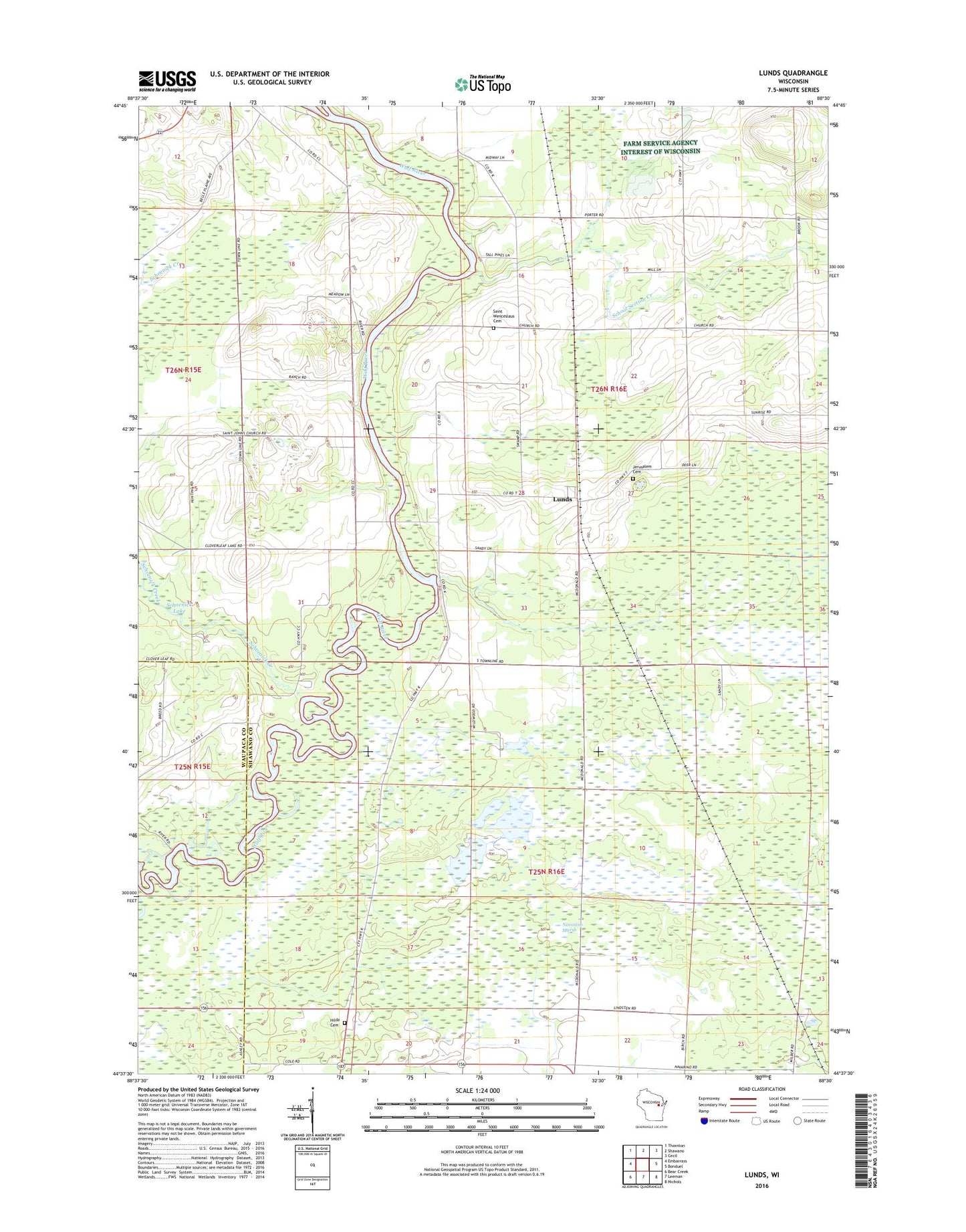
2018 topographic map quadrangle Lunds in the state of Wisconsin. Scale: 1:24000. Based on the newly updated USGS 7.5' US Topo map series, this map is in the following counties: Shawano, Waupaca. The map contains contour data, water features, and other items you are used to seeing on USGS maps, but also has updated roads and other features. This is the next generation of topographic maps. Printed on high-quality waterproof paper with UV fade-resistant inks.
Quads adjacent to this one:
West: Embarrass
Northwest: Thornton
North: Shawano
Northeast: Cecil
East: Bonduel
Southeast: Nichols
South: Leeman
Southwest: Bear Creek
Contains the following named places: Ascension Church, First Church, Jerusalem Cemetery, Jerusalem Church, Lunds, Navarino Marsh, Navarino Marsh 1 G12.470 Dam, Navarino Marsh 2 G12.470 Dam, Navarino Marsh 3 G12.470 Dam, Navarino State Wildlife Area, Norwegian Cemetery, Saint Johns Church, Saint Wenceslaus Cemetery, Saint Wenceslaus Church, Schoenick Creek, School Section Creek, Town of Navarino, Town of Waukechon