
MyTopo
Mole Lake Wisconsin US Topo Map
Couldn't load pickup availability
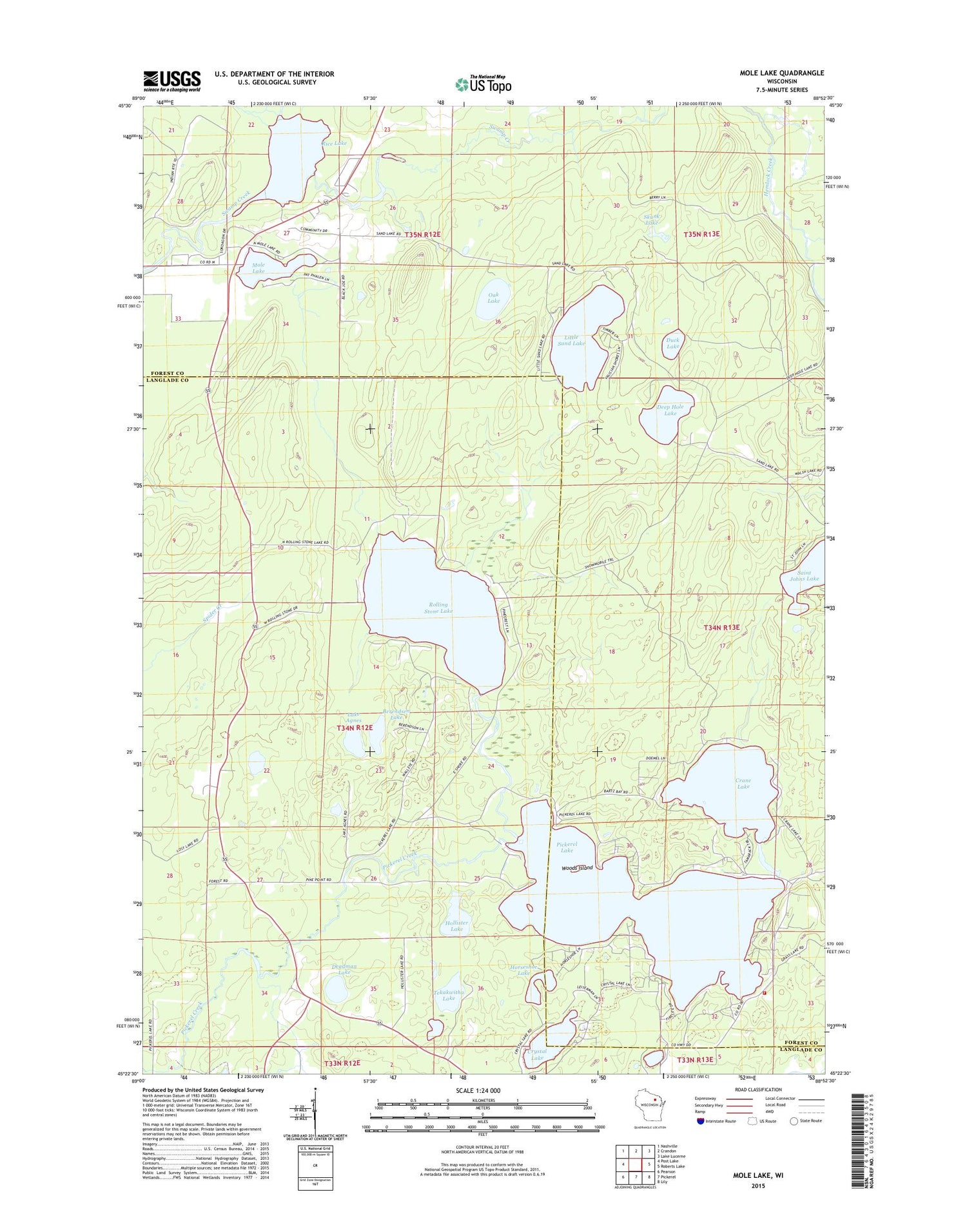
2018 topographic map quadrangle Mole Lake in the state of Wisconsin. Scale: 1:24000. Based on the newly updated USGS 7.5' US Topo map series, this map is in the following counties: Forest, Langlade. The map contains contour data, water features, and other items you are used to seeing on USGS maps, but also has updated roads and other features. This is the next generation of topographic maps. Printed on high-quality waterproof paper with UV fade-resistant inks.
Quads adjacent to this one:
West: Post Lake
Northwest: Nashville
North: Crandon
Northeast: Lake Lucerne
East: Roberts Lake
Southeast: Lily
South: Pickerel
Southwest: Pearson
Contains the following named places: Arbutus Church, Arbutus School, Berendsen Lake, Crane Lake, Crystal Lake, Deadman Lake, Deep Hole Lake, Duck Lake, Gliske Creek, Harper Lake, Hollister Lake, Horseshoe Lake, K Lookout Tower, Kingdom Hall, Lake Agnes, Learned Lake, Little Sand Lake, Mole Lake, Mole Lake Census Designated Place, Oak Lake, Outlet Creek, Pickerel Lake, Pickerel Volunteer Fire and Rescue Station 1, Rice Lake, Rolling Stone Lake, Saint Johns Lake, Skunk Lake, Sokaogon Chippewa Community, Sunken Lake, Tekakwitha Lake, Town of Ainsworth, Woods Island, ZIP Code: 54465


