MyTopo
Neopit Wisconsin US Topo Map
Couldn't load pickup availability
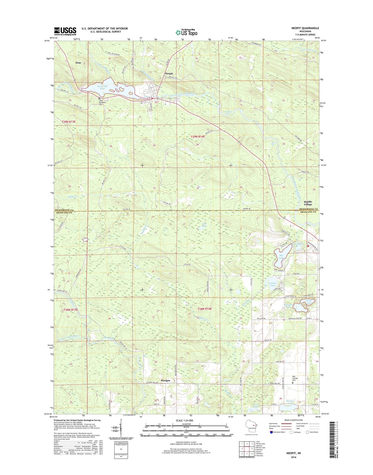
2022 topographic map quadrangle Neopit in the state of Wisconsin. Scale: 1:24000. Based on the newly updated USGS 7.5' US Topo map series, this map is in the following counties: Shawano, Menominee. The map contains contour data, water features, and other items you are used to seeing on USGS maps, but also has updated roads and other features. This is the next generation of topographic maps. Printed on high-quality waterproof paper with UV fade-resistant inks.
Quads adjacent to this one:
West: Burney Lake
Northwest: Zoar
North: Perote Lake
Northeast: Markton
East: Keshena
Southeast: Thornton
South: Gresham
Southwest: Bowler
This map covers the same area as the classic USGS quad with code o44088h7.
Contains the following named places: Beaulieu Lake, Big Lake, El Mohican School, Immanuel-Mohican Church, Island Creek, Island Lake, Koonz Lake, Little West Branch Wolf River, Lost Lake, Menominee Indian Middle School, Menominee Reservation/Stockbridge Munsee Community joint-use area, Menominee Tribal School, Middle Village Fire Department, Mission Lake, Moon Lake, Morgan, Mud Lake, Neopit, Neopit Census Designated Place, Neopit Dam, Neopit Fire Department, Neopit Mill Pond, Neopit Millpond 108, Neopit Post Office, Peavey Falls, Rainbow Falls, Red Springs Cemetery, Red Springs Town Hall, Saint Anthony Cemetery, Saint Anthonys Roman Catholic Church, Saint Anthonys School, Smith Creek, Stockbridge Church, Tourtillotte Creek, Town of Red Springs, West Branch Red River, ZIP Codes: 54128, 54150