MyTopo
Tigerton Wisconsin US Topo Map
Couldn't load pickup availability
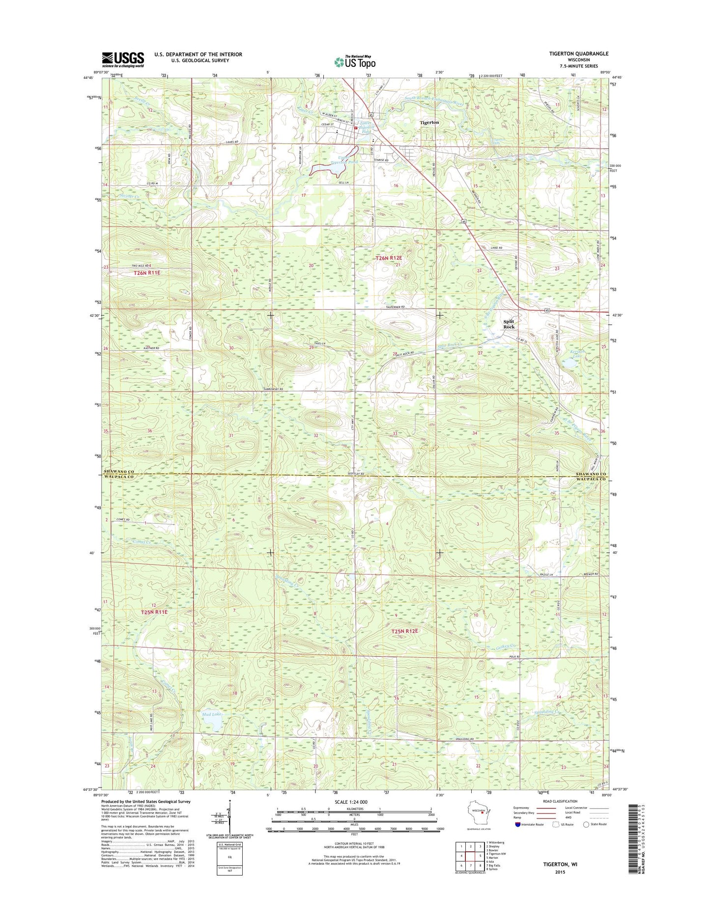
2018 topographic map quadrangle Tigerton in the state of Wisconsin. Scale: 1:24000. Based on the newly updated USGS 7.5' US Topo map series, this map is in the following counties: Shawano, Waupaca. The map contains contour data, water features, and other items you are used to seeing on USGS maps, but also has updated roads and other features. This is the next generation of topographic maps. Printed on high-quality waterproof paper with UV fade-resistant inks.
Quads adjacent to this one:
West: Tigerton NW
Northwest: Wittenberg
North: Shepley
Northeast: Bowler
East: Marion
Southeast: Symco
South: Big Falls
Southwest: Iola
Contains the following named places: Beetle Creek, Jones Creek, Kersten Lake, Kerstens Greenhouse, Lower Tigerton Pond, Mud Lake, Mud Lake Bog State Natural Area, Split Rock, Split Rock Creek, Steinke Creek, Tiger Creek, Tigerton, Tigerton Area Ambulance Service, Tigerton Dells, Tigerton Elementary School, Tigerton Middle and High School, Tigerton Police Department, Tigerton Post Office, Tigerton Volunteer Fire Department, Town of Fairbanks, Town of Wyoming, Upper Tigerton Pond, Village of Tigerton, ZIP Code: 54486