MyTopo
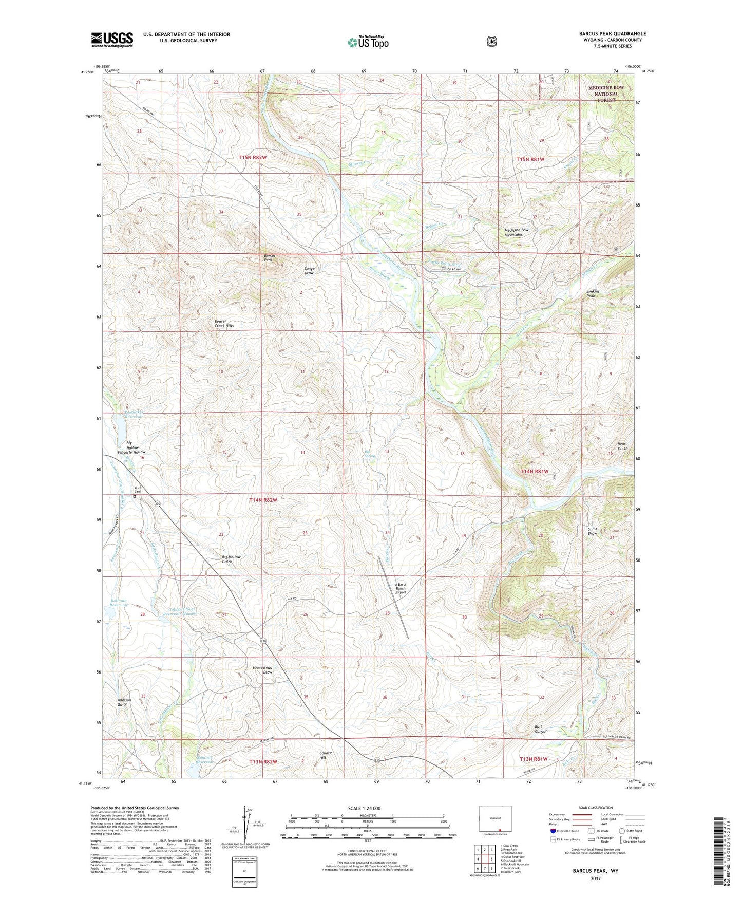
Barcus Peak Wyoming US Topo Map
Couldn't load pickup availability
Also explore the Barcus Peak Forest Service Topo of this same quad for updated USFS data
2021 topographic map quadrangle Barcus Peak in the state of Wyoming. Scale: 1:24000. Based on the newly updated USGS 7.5' US Topo map series, this map is in the following counties: Carbon. The map contains contour data, water features, and other items you are used to seeing on USGS maps, but also has updated roads and other features. This is the next generation of topographic maps. Printed on high-quality waterproof paper with UV fade-resistant inks.
Quads adjacent to this one:
West: Gunst Reservoir
Northwest: Cow Creek
North: Ryan Park
Northeast: Phantom Lake
East: Overlook Hill
Southeast: Elkhorn Point
South: Trent Creek
Southwest: Blackhall Mountain
This map covers the same area as the classic USGS quad with code o41106b5.
Contains the following named places: A Bar A Ranch Airport, Addison Gulch, Bacus Ditch, Barcus Creek, Barcus Peak, Bear Creek, Bear Gulch, Beaver Creek Hills, Beaver Creek School, Big Creek, Big Hollow, Big Hollow Gulch, Big Spring, Bull Canyon, Bull Creek, Coyote Hill, Fingerle Hollow, French Creek, French Creek Ranch, Golden Clover Mine, Golden Clover Number 1 Dam, Golden Clover Reservoir Number 1, Golden Clover Reservoir Number 2, Homestead Draw, Jenkins Peak, Jenkins Ranch, Little Beaver Creek, Little Creek, Platt Cemetery, Platt Ranch, Platt Ranch Airport, Reservoir Creek, Rocky Point Ditch, Rollman Reservoir, Sanger Draw, Sanger Ranch, School Creek, Slims Draw, Summit Dam, Summit Reservoir, Toothaker Dam, Toothaker Reservoir