MyTopo
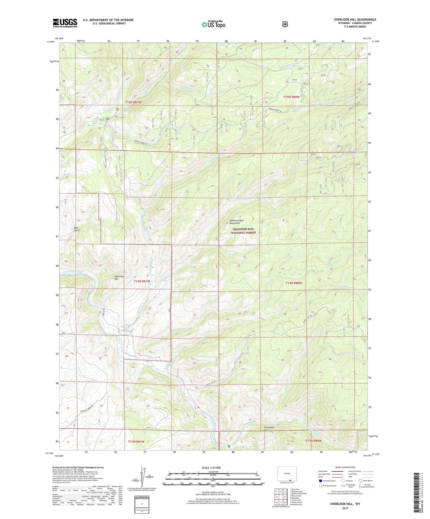
Overlook Hill Wyoming US Topo Map
Couldn't load pickup availability
Also explore the Overlook Hill Forest Service Topo of this same quad for updated USFS data
2021 topographic map quadrangle Overlook Hill in the state of Wyoming. Scale: 1:24000. Based on the newly updated USGS 7.5' US Topo map series, this map is in the following counties: Carbon. The map contains contour data, water features, and other items you are used to seeing on USGS maps, but also has updated roads and other features. This is the next generation of topographic maps. Printed on high-quality waterproof paper with UV fade-resistant inks.
Quads adjacent to this one:
West: Barcus Peak
Northwest: Ryan Park
North: Phantom Lake
Northeast: Medicine Bow Peak
East: Keystone
Southeast: Horatio Rock
South: Elkhorn Point
Southwest: Trent Creek
This map covers the same area as the classic USGS quad with code o41106b4.
Contains the following named places: A Bar A Ranch, Anderson Ditch, Boat Creek, Cottonwood Creek, Dirty Petes Cabin, Douglas Creek, Douglas Creek Picnic Ground, French Creek Picnic Ground, French Creek Ranch, Hubbell Ditch, Lenhardys Cabin, Mullen Creek, North French Creek, North Mullen Creek, Overlook Hill, Savage Run Creek, Savage Run Wilderness, Sheep Creek, Sourdough Creek, South French Creek, South Mullen Creek, Stovepipe Hill