MyTopo
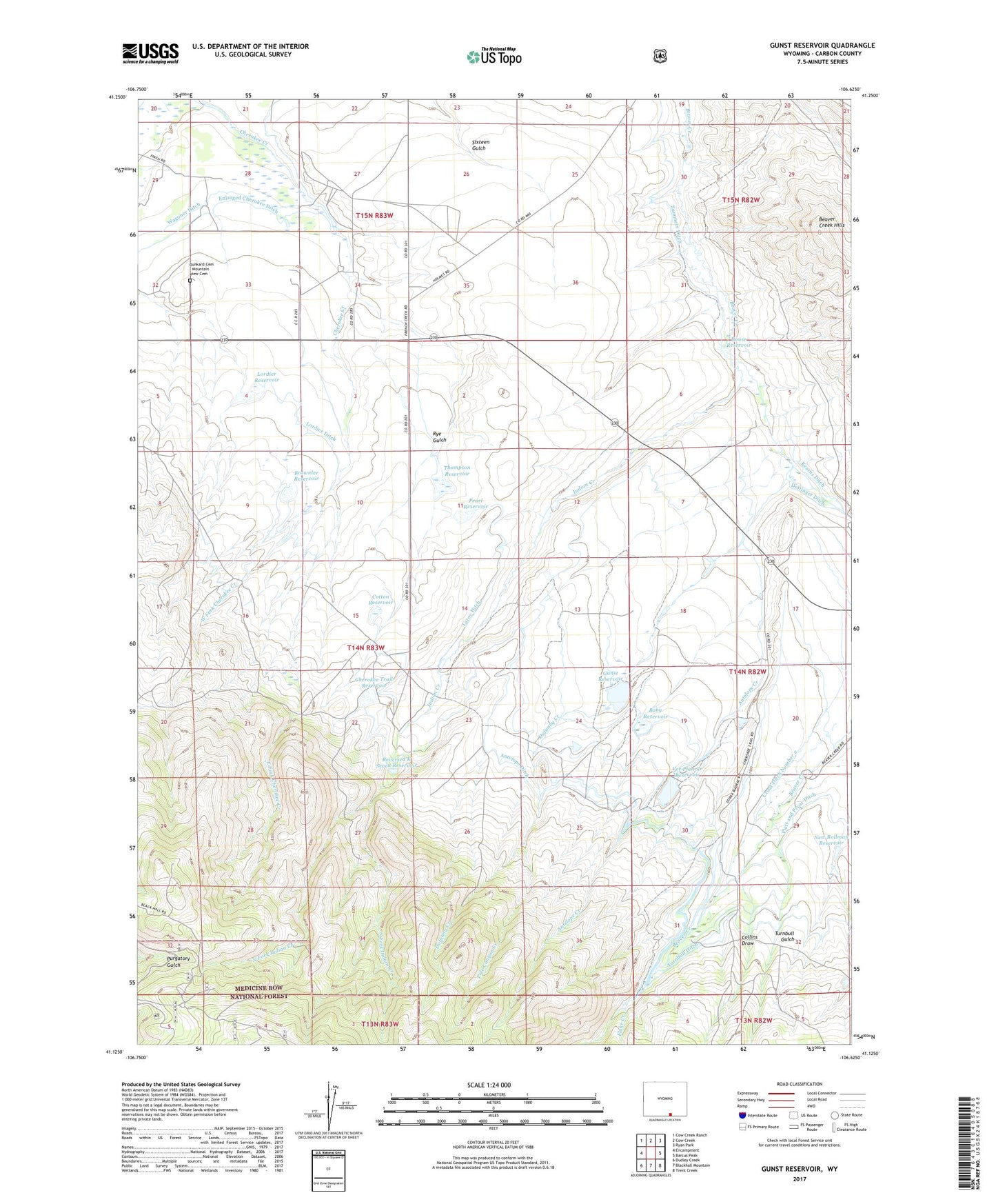
Gunst Reservoir Wyoming US Topo Map
Couldn't load pickup availability
Also explore the Gunst Reservoir Forest Service Topo of this same quad for updated USFS data
2021 topographic map quadrangle Gunst Reservoir in the state of Wyoming. Scale: 1:24000. Based on the newly updated USGS 7.5' US Topo map series, this map is in the following counties: Carbon. The map contains contour data, water features, and other items you are used to seeing on USGS maps, but also has updated roads and other features. This is the next generation of topographic maps. Printed on high-quality waterproof paper with UV fade-resistant inks.
Quads adjacent to this one:
West: Encampment
Northwest: Cow Creek Ranch
North: Cow Creek
Northeast: Ryan Park
East: Barcus Peak
Southeast: Trent Creek
South: Blackhall Mountain
Southwest: Dudley Creek
This map covers the same area as the classic USGS quad with code o41106b6.
Contains the following named places: Anderson Ditch, Anderson Ranch, Antelope Creek, Antelope Ditch, Baby Reservoir, Brownlee Reservoir, Buffalo Ditch, Charokee Trail Dam, Cherokee Trail Reservoir, Collins Ditch Number 1, Collins Draw, Cotton Reservoir, Crout Ditch Number 1, Crout Ditch Number 2, Dettinger Ditch, Dufunny Creek, East Fork Cherokee Creek, Enlarged Cherokee Ditch, Enlarged Encampment Ditch, Flohr Creek, Gunst Dam, Gunst Reservoir, Indian Creek, Indian Creek Ranch, Kearns Ditch, Laroy Ditch, Lordier Dam, Lordier Ditch, Lordier Reservoir, Mountain View Cemetery, New Rollman Reservoir, North Fork Indian Creek, Pearl Dam, Pearl Reservoir, Platt and Pryor Ditch, Pole Canyon Creek, Reservoir Ditch, Reversed K Seven Reservoir, Rollman Ditch, Rouse Reservoir, Rouse Stockwater Dam, Rye Gulch, Sierra Madre Ranch, South Fork Indian Creek, Summers Ditch, Thompson Reservoir, Toothaker Brothers Ditch, Toothaker Ditch Number 1 and 2, Toothaker Ditch Number 2, Turnbull Ditch, Turnbull Gulch, Ver Plancke Reservoir, Ver Plancke Snow Water Ditch, Verplanke Dam, Wagoner Ditch, West Fork Cherokee Creek, ZIP Code: 82325