
MyTopo
Keystone Wyoming US Topo Map
Couldn't load pickup availability
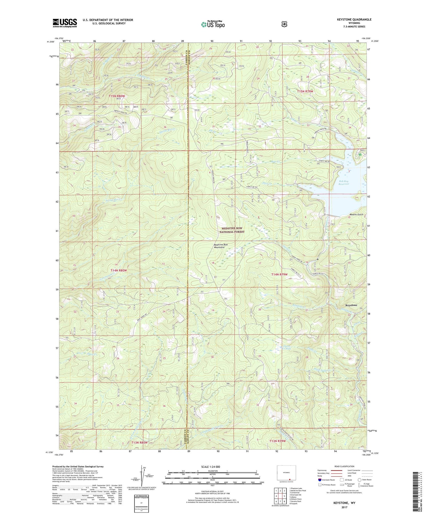
2021 topographic map quadrangle Keystone in the state of Wyoming. Scale: 1:24000. Based on the newly updated USGS 7.5' US Topo map series, this map is in the following counties: Albany, Carbon. The map contains contour data, water features, and other items you are used to seeing on USGS maps, but also has updated roads and other features. This is the next generation of topographic maps. Printed on high-quality waterproof paper with UV fade-resistant inks.
Quads adjacent to this one:
West: Overlook Hill
Northwest: Phantom Lake
North: Medicine Bow Peak
Northeast: Centennial
East: Albany
Southeast: Foxpark
South: Horatio Rock
Southwest: Elkhorn Point
Contains the following named places: Ak-sar-ben Group Mine, Albany Development Company Mine, Albany Placer Mine, Bear Creek, Dave Creek, Douglas Creek Campground, Douglas Mine, Duchess Mine, East Fork Devils Gate Creek, Elk Creek, Florence Mine, Flume Creek, Flume Creek Park, Golden Key Mine, Hamilton Group Mine, Holmes Campground, Home Placers Mine, Horse Creek, Inversion Cabin Prospects, Jays Roost, Jim Creek, Keystone, Keystone Creek, Keystone Guard Station, Keystone Mine, Keystone Ranger Station, Lewis Creek, Little Beaver Creek, Maudem Group Mine, Moores Gulch Mine, Morning Star Claim, New Rambler Mine, Rambler Mine, Rob Roy Dam, Rob Roy Reservoir, Rush Creek, Sunset Mine, Thompson Dam, Thompson Reservoir, West Mullen Creek, White Swan Creek, Willow Creek


