MyTopo
Man Peak Wyoming US Topo Map
Couldn't load pickup availability
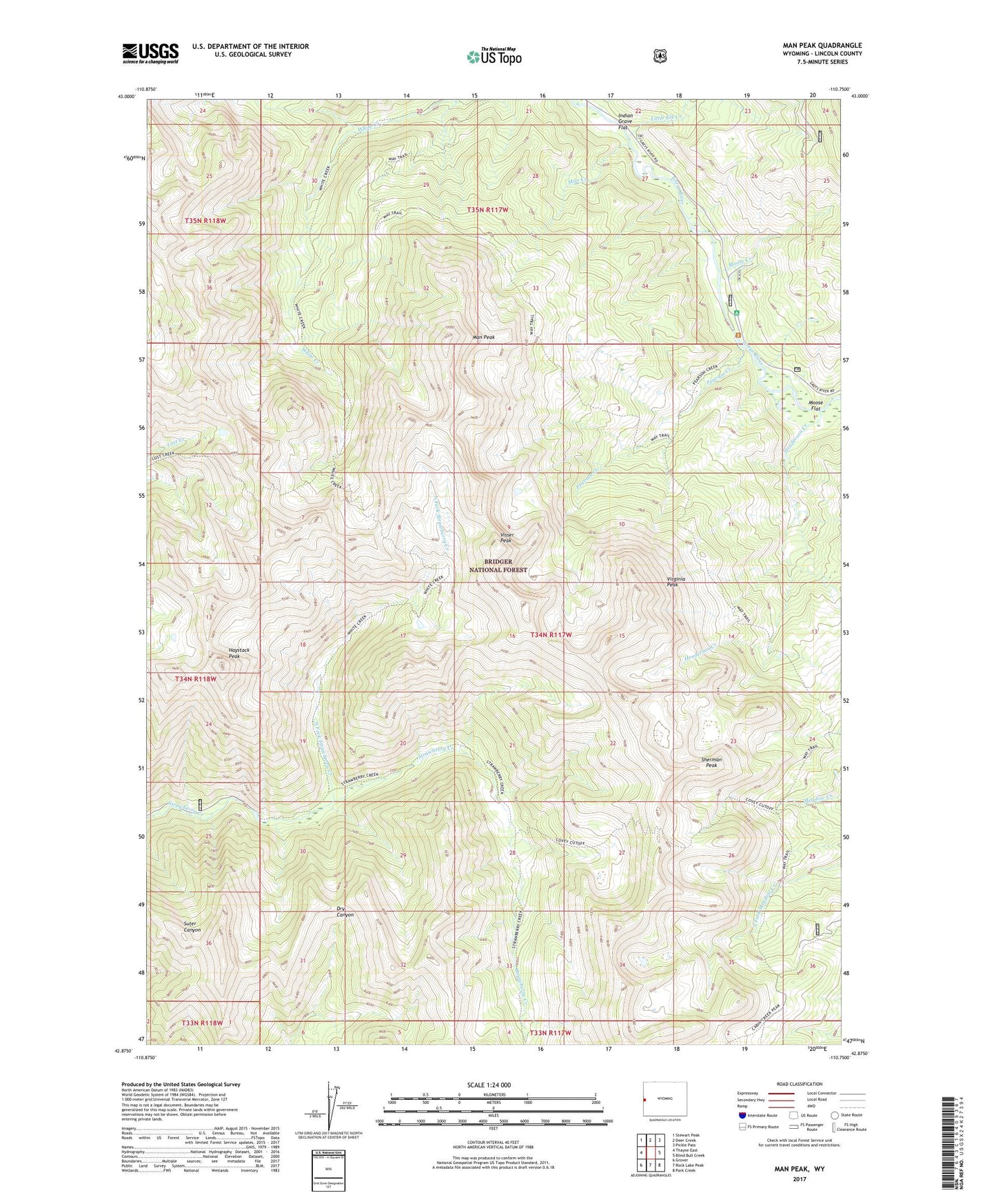
2021 topographic map quadrangle Man Peak in the state of Wyoming. Scale: 1:24000. Based on the newly updated USGS 7.5' US Topo map series, this map is in the following counties: Lincoln. The map contains contour data, water features, and other items you are used to seeing on USGS maps, but also has updated roads and other features. This is the next generation of topographic maps. Printed on high-quality waterproof paper with UV fade-resistant inks.
Quads adjacent to this one:
West: Thayne East
Northwest: Stewart Peak
North: Deer Creek
Northeast: Pickle Pass
East: Blind Bull Creek
Southeast: Park Creek
South: Rock Lake Peak
Southwest: Grover
Contains the following named places: Afton Division, Haystack Peak, Indian Grave Flat, Little Elk Creek, Man Creek, Man Peak, Moose Creek, Moose Flat, Moose Flat Campground, North Fork Strawberry Creek, Pearson Creek, Sherman Peak, Virginia Peak, Visser Peak, Wyoming Game and Fish Administrative Site, ZIP Code: 83112