MyTopo
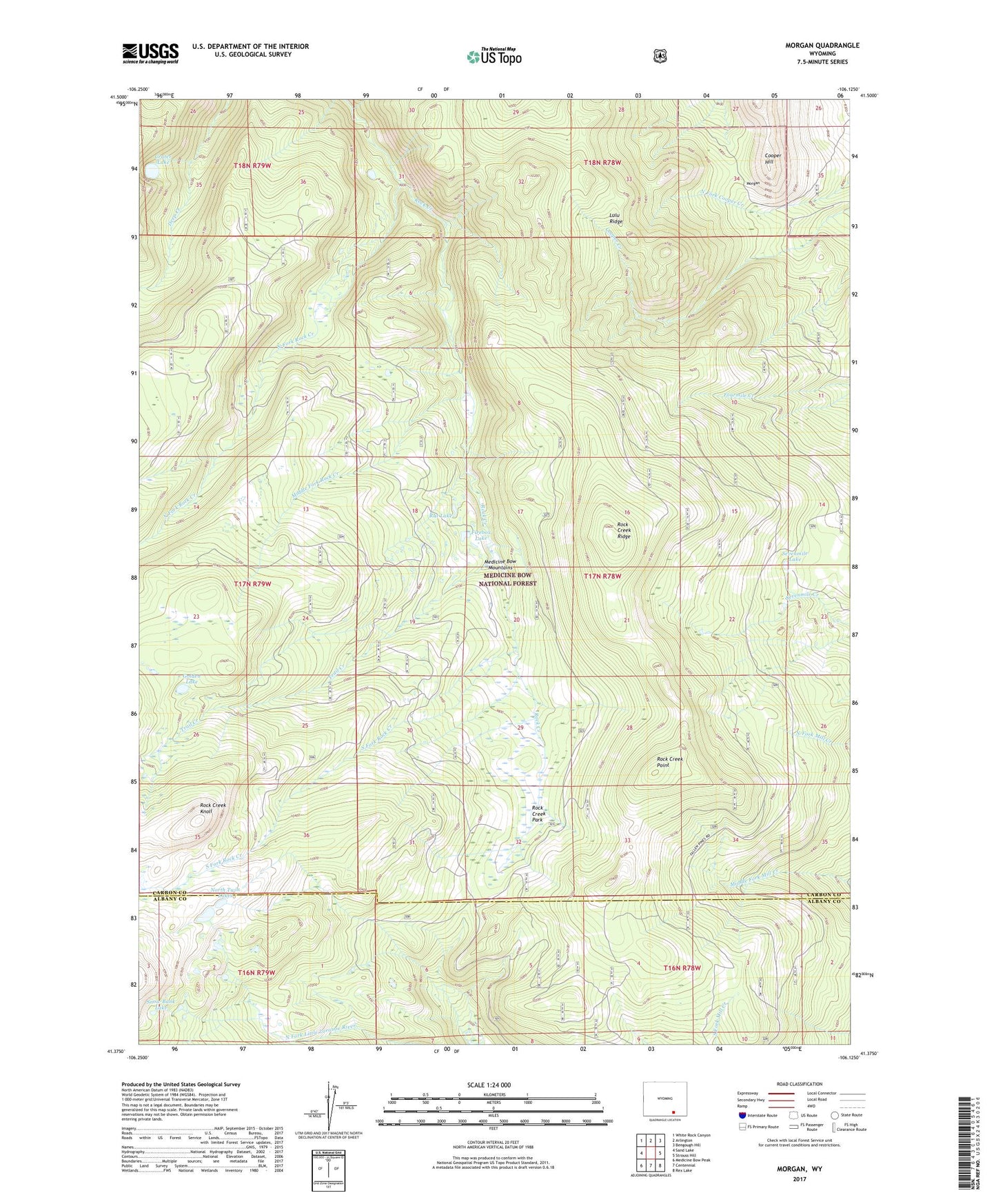
Morgan Wyoming US Topo Map
Couldn't load pickup availability
2021 topographic map quadrangle Morgan in the state of Wyoming. Scale: 1:24000. Based on the newly updated USGS 7.5' US Topo map series, this map is in the following counties: Carbon, Albany. The map contains contour data, water features, and other items you are used to seeing on USGS maps, but also has updated roads and other features. This is the next generation of topographic maps. Printed on high-quality waterproof paper with UV fade-resistant inks.
Quads adjacent to this one:
West: Sand Lake
Northwest: White Rock Canyon
North: Arlington
Northeast: Bengough Hill
East: Strouss Hill
Southeast: Rex Lake
South: Centennial
Southwest: Medicine Bow Peak
Contains the following named places: Arlington Pack Trail, Clark Park, Cooper Hill, Crater Lake, Firebox Lake, Golden Lake, Lulu Ridge, Middle Fork Rock Creek, Morrisey, North Fork Observation Point, North Fork Rock Creek, North Twin Lakes, Rat Lake, Rock Creek Knoll, Rock Creek Park, Rock Creek Point, Rock Creek Ridge, Sevenmile Lake, Snow Bank Lake, South Fork Rock Creek, Trail Creek