MyTopo
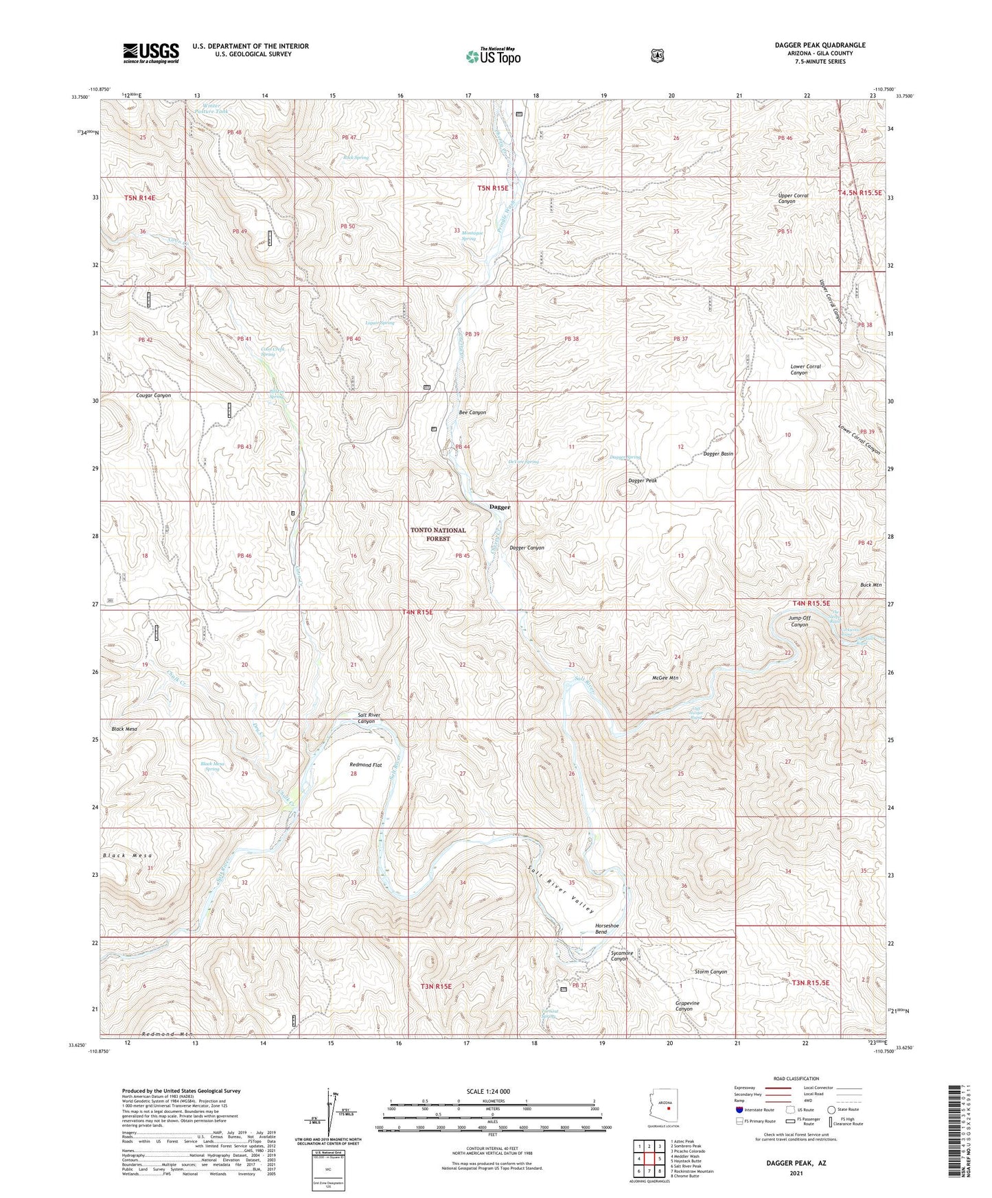
Dagger Peak Arizona US Topo Map
Couldn't load pickup availability
Also explore the Dagger Peak Forest Service Topo of this same quad for updated USFS data
2021 topographic map quadrangle Dagger Peak in the state of Arizona. Scale: 1:24000. Based on the newly updated USGS 7.5' US Topo map series, this map is in the following counties: Gila. The map contains contour data, water features, and other items you are used to seeing on USGS maps, but also has updated roads and other features. This is the next generation of topographic maps. Printed on high-quality waterproof paper with UV fade-resistant inks.
Quads adjacent to this one:
West: Meddler Wash
Northwest: Aztec Peak
North: Sombrero Peak
Northeast: Picacho Colorado
East: Haystack Butte
Southeast: Chrome Butte
South: Rockinstraw Mountain
Southwest: Salt River Peak
This map covers the same area as the classic USGS quad with code o33110f7.
Contains the following named places: Bee Canyon, Bill Lee Spring, Black Mesa Spring, Buck Mountain, Burnt Canyon Tank, Chalk Creek, Cherry Creek, Cliff Hanger Rapid, Coon Creek, Coon Creek Spring, Corkscrew Rapid, Cougar Canyon, Dagger, Dagger Basin, Dagger Canyon, Dagger Peak, Dagger Ranch, Dagger Spring, DeVore Spring, Dry Creek, Dry Creek Well, Grapevine Canyon, Horseshoe Bend, Jump-Off Canyon, Lawrence Creek, Liquor Spring, McGee Mountain, Montague Spring, Montague Well, Mud Springs Wash, Natural Well, Pringle Wash, Pringle Well, Quartzite Rapid, Redmond Flat, Redmond Wash, Rock Spring, Salt River Canyon Wilderness, Storm Canyon, Storm Canyon Well, Sycamore Canyon, The Sleeper Rapid, Turnout Spring, Winter Pasture Tank