MyTopo
Rockinstraw Mountain Arizona US Topo Map
Couldn't load pickup availability
Also explore the Rockinstraw Mountain Forest Service Topo of this same quad for updated USFS data
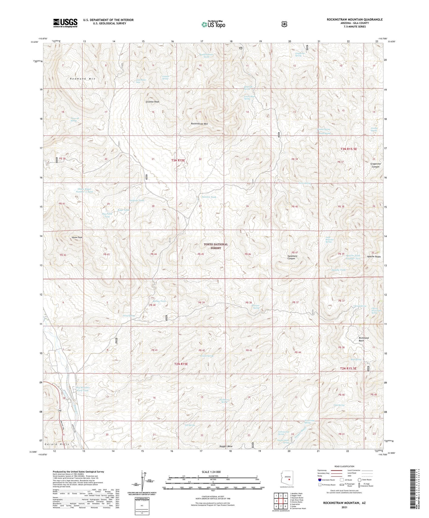
2023 topographic map quadrangle Rockinstraw Mountain in the state of Arizona. Scale: 1:24000. Based on the newly updated USGS 7.5' US Topo map series, this map is in the following counties: Gila. The map contains contour data, water features, and other items you are used to seeing on USGS maps, but also has updated roads and other features. This is the next generation of topographic maps. Printed on high-quality waterproof paper with UV fade-resistant inks.
Quads adjacent to this one:
West: Salt River Peak
Northwest: Meddler Wash
North: Dagger Peak
Northeast: Haystack Butte
East: Chrome Butte
Southeast: Cammerman Wash
South: Globe
Southwest: Inspiration
This map covers the same area as the classic USGS quad with code o33110e7.
Contains the following named places: Alamo Ranger Station, Apache Tank, Apache Tank Number Two, Ash Spring, Big Pasture Well, Big Pond Tank, Bixby Well, Brewster Well, Brush Spring, Brushy Spring, Cement Spring, Cherry Horizontal Spring, Cherry Spring, Cold Water Seep, Cottonwood Spring, Dry Weather Ford Tank, Ginn Spring, Globe Division, Globe-Miami Division, Granite Peak, Granite Spring, Grapevine Spring, Hackberry Spring, Hicks Wash, Horse Spring, Horseshoe Bend Wash, Jackson Tank, Jump-off Spring, Kyles Tank, Little Brewster Spring, Little Mud Well, Lower Mud Spring, Lower Well, Mint Spring, Murray Wash, Negro Wash, Negro Well, New Water Well, Nugget Mesa, Nugget Wash Spring, Price Tank, Procopio Spring, Rays Tank, Redmond Mountain, Redmond Tank, Redmond Well, Richmond Basin, Riley Well, Rockinstraw Mountain, Rockinstraw Tank, Rockinstraw Tank Number Two, Rocky Tank, Rough Canyon Tank, Shute Road Number 2 Tank, Shute Road Well, Squaw Peak, Summit Tank, Summit Well, Sycamore Well, Tom Camp Spring, Upper Well, Wood Road Well, Wood Spring, Wood Springs Wash, ZIP Code: 85501