MyTopo
Marion West Louisiana US Topo Map
Couldn't load pickup availability
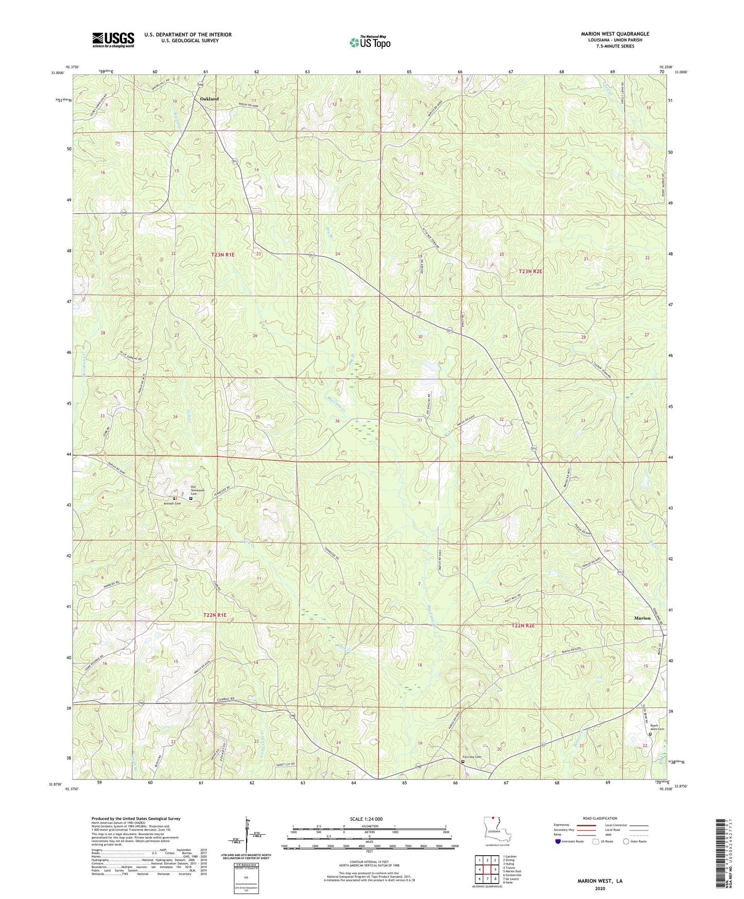
2024 topographic map quadrangle Marion West in the state of Louisiana. Scale: 1:24000. Based on the newly updated USGS 7.5' US Topo map series, this map is in the following counties: Union. The map contains contour data, water features, and other items you are used to seeing on USGS maps, but also has updated roads and other features. This is the next generation of topographic maps. Printed on high-quality waterproof paper with UV fade-resistant inks.
Quads adjacent to this one:
West: Truxno
Northwest: Gardner
North: Strong
Northeast: Huttig
East: Marion East
Southeast: Haile
South: De Loutre
Southwest: Farmerville
This map covers the same area as the classic USGS quad with code o32092h3.
Contains the following named places: Antioch Cemetery, Antioch Church, Center Branch Church, Concord Church, Dry Branch, Fairview Cemetery, Fairview Church, Good Hope Church, Meridian Church, Mount Horeb Church, Mount Union Church, Oakland, Oakland Lookout Tower, Old Tennessee Cemetery, Parish Governing Authority District 6, Pine Vale Church, Roark Allen Cemetery, Tick Creek, Union State Wildlife Management Area, Union Wildlife Management Area, Ward Six