
MyTopo
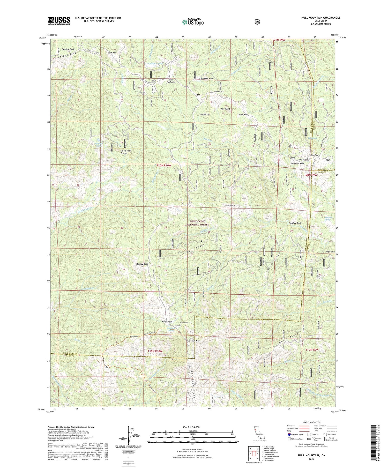
Hull Mountain California US Topo Map
Couldn't load pickup availability
Also explore the Hull Mountain Forest Service Topo of this same quad for updated USFS data
2021 topographic map quadrangle Hull Mountain in the state of California. Scale: 1:24000. Based on the newly updated USGS 7.5' US Topo map series, this map is in the following counties: Mendocino, Lake, Glenn. The map contains contour data, water features, and other items you are used to seeing on USGS maps, but also has updated roads and other features. This is the next generation of topographic maps. Printed on high-quality waterproof paper with UV fade-resistant inks.
Quads adjacent to this one:
West: Sanhedrin Mountain
Northwest: Thatcher Ridge
North: Plaskett Ridge
Northeast: Plaskett Meadows
East: Kneecap Ridge
Southeast: Crockett Peak
South: Lake Pillsbury
Southwest: Van Arsdale Reservoir
This map covers the same area as the classic USGS quad with code o39122e8.
Contains the following named places: Appletree Spring, Bald Mountain, Barley Lake, Bean Rock, Big Spring, Boardman Ridge, Booth Crossing, Calamese Rock, Cherry Hill, Chipmunk Spring, Cushman Camp, Cushman Lake, Devils Rock Garden, Goat Camp, Goat Rock, Graves Cabin, Hells Half Acre, Horse Ridge, Hull Creek, Hull Mountain, Hull Mountain Lookout, Hulls Grave, Lee Logan Camp, Little Bear Rock, Long Doe Ridge, Mendenhall Camp, Millsap Cabin, Monkey Rock, Panther Ridge, Panther Rock, Pole Point, Red Rock, Red Rock Ridge, Spruce Grove Campground, Swallow Rock, Tar Flat, Tar Flat Forest Service Facility, Timberline Camp, Wesley Ives Creek, Windy Gap, Windy Point, Yuki Wilderness


