MyTopo
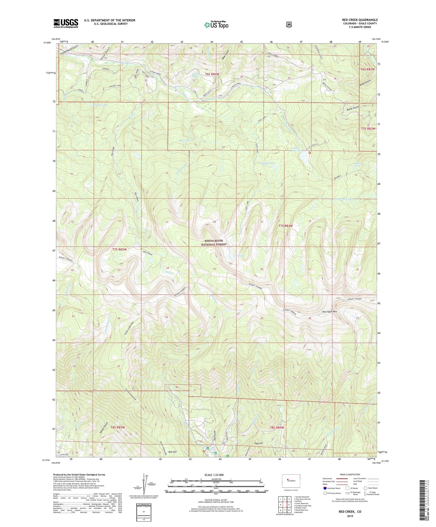
Red Creek Colorado US Topo Map
Couldn't load pickup availability
Also explore the Red Creek Forest Service Topo of this same quad for updated USFS data
2022 topographic map quadrangle Red Creek in the state of Colorado. Scale: 1:24000. Based on the newly updated USGS 7.5' US Topo map series, this map is in the following counties: Eagle. The map contains contour data, water features, and other items you are used to seeing on USGS maps, but also has updated roads and other features. This is the next generation of topographic maps. Printed on high-quality waterproof paper with UV fade-resistant inks.
Quads adjacent to this one:
West: Toner Reservoir
Northwest: Suicide Mountain
North: The Seven Hermits
Northeast: Fulford
East: Crooked Creek Pass
Southeast: Meredith
South: Ruedi Reservoir
Southwest: Woody Creek
This map covers the same area as the classic USGS quad with code o39106d7.
Contains the following named places: Alkali Gulch, Alldred Spring, Antones Spring, Bagley Creek, Basalt Division, Bear Gulch, Campbell Creek, Dry Gulch, Fence Gulch, Frenchman Creek, Gyp Hill, Hells Hole, LEDE Dam, LEDE Reservoir, LEDE Reservoir Campground, Lost Lake, Muckey Lake, Ragged Lakes, Red Creek, Red Creek Campground, Red Hill, Red Table Mountain, Rock Lake, Schoolhouse Gulch, White Creek, ZIP Code: 81621