MyTopo
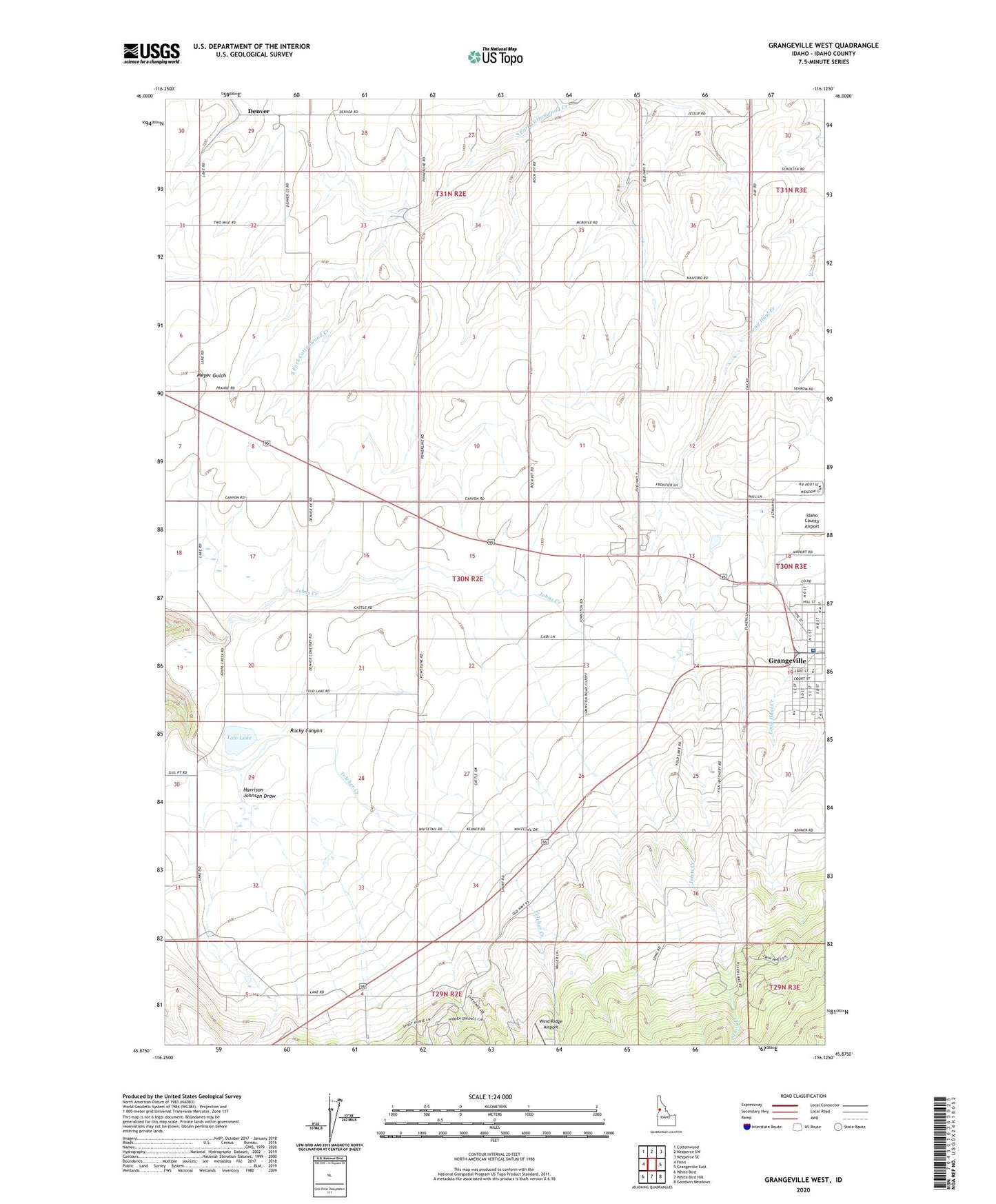
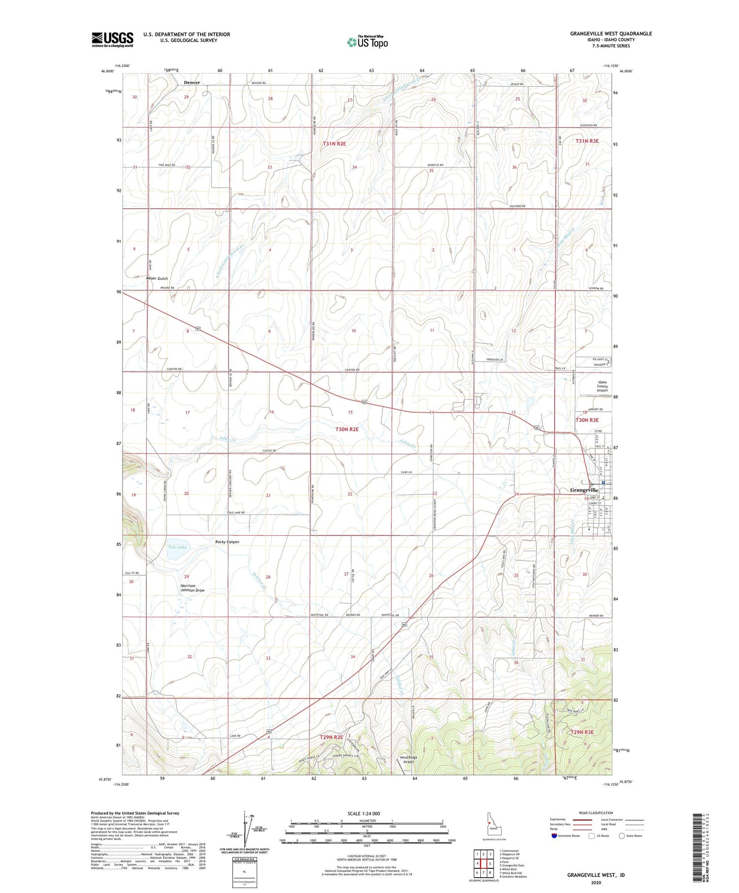
Grangeville West Idaho US Topo Map
Couldn't load pickup availability
Also explore the Grangeville West Forest Service Topo of this same quad for updated USFS data
2024 topographic map quadrangle Grangeville West in the state of Idaho. Scale: 1:24000. Based on the newly updated USGS 7.5' US Topo map series, this map is in the following counties: Idaho. The map contains contour data, water features, and other items you are used to seeing on USGS maps, but also has updated roads and other features. This is the next generation of topographic maps. Printed on high-quality waterproof paper with UV fade-resistant inks.
Quads adjacent to this one:
West: Fenn
Northwest: Cottonwood
North: Nezperce SW
Northeast: Nezperce SE
East: Grangeville East
Southeast: Goodwin Meadows
South: White Bird Hill
Southwest: White Bird
This map covers the same area as the classic USGS quad with code o45116h2.
Contains the following named places: Denver, Grangeville Golf and Country Club, Grangeville Hatchery, Grangeville High School, Johns Creek Dam, KORT-AM (Grangeville), Magger, Saints Peter and Paul School, Syringa General Hospital, Tolo Lake, Tolo Lake Access Area, Wind Ridge Airport