MyTopo
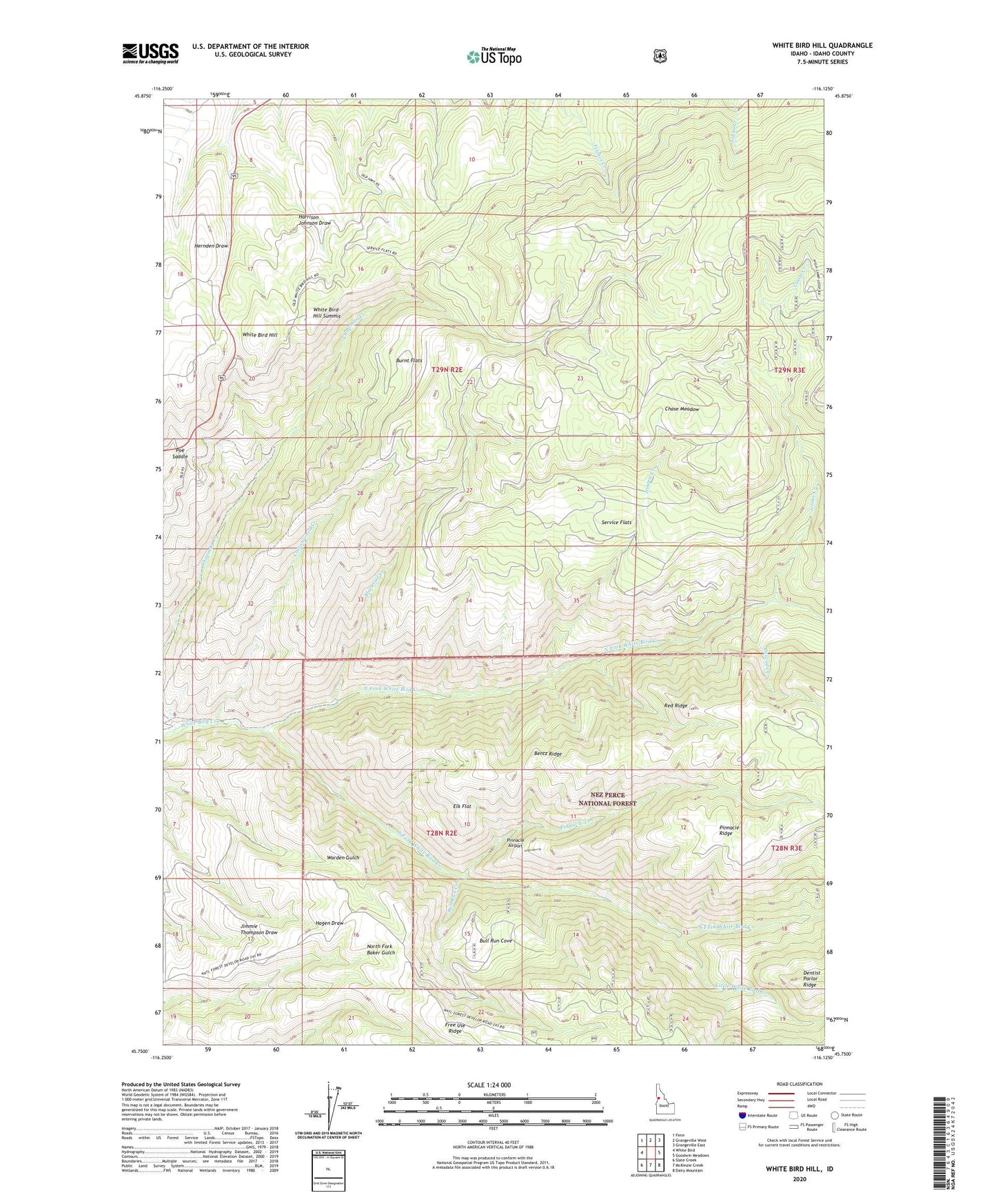
White Bird Hill Idaho US Topo Map
Couldn't load pickup availability
Also explore the White Bird Hill Forest Service Topo of this same quad for updated USFS data
2024 topographic map quadrangle White Bird Hill in the state of Idaho. Scale: 1:24000. Based on the newly updated USGS 7.5' US Topo map series, this map is in the following counties: Idaho. The map contains contour data, water features, and other items you are used to seeing on USGS maps, but also has updated roads and other features. This is the next generation of topographic maps. Printed on high-quality waterproof paper with UV fade-resistant inks.
Quads adjacent to this one:
West: White Bird
Northwest: Fenn
North: Grangeville West
Northeast: Grangeville East
East: Goodwin Meadows
Southeast: Dairy Mountain
South: McKinzie Creek
Southwest: Slate Creek
This map covers the same area as the classic USGS quad with code o45116g2.
Contains the following named places: Bentz Ridge, Blacktail Creek, Bull Run Cove, Bull Run Creek, Burnt Flats, Cascade Creek, Chase Meadow, Cottonwood Creek, East Fork Goose Creek, Elk Flat, Goose Creek, Grangeville Division, Harrison Johnson Draw, Hernden Draw, Jimmie Creek, Little White Bird Creek, North Fork White Bird Creek, Pinnacle Airport, Pinnacle Creek, Poe Saddle, Red Ridge, Service Flats, South Fork White Bird Creek, White Bird Hill, White Bird Hill Summit