MyTopo
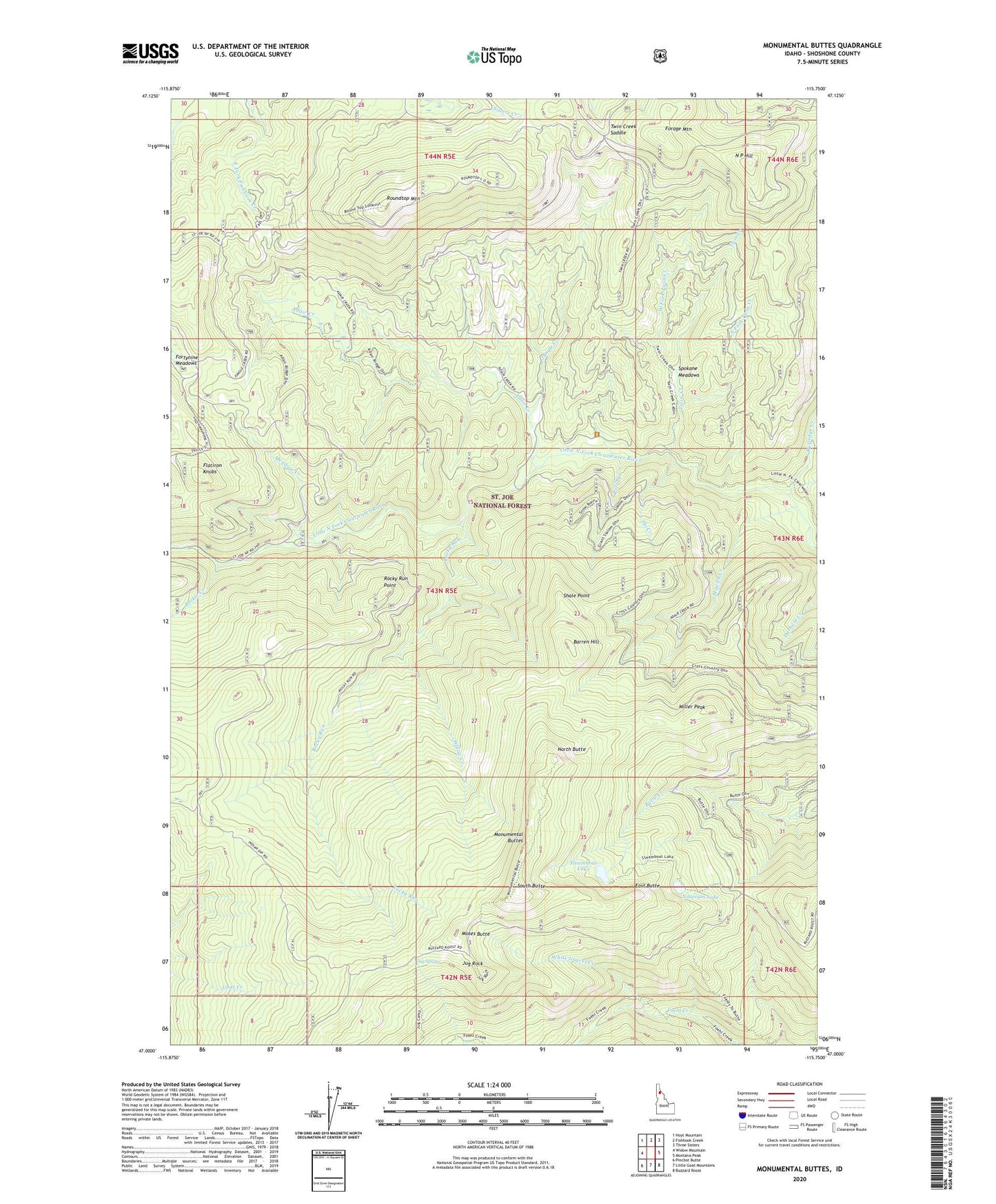
Monumental Buttes Idaho US Topo Map
Couldn't load pickup availability
Also explore the Monumental Buttes Forest Service Topo of this same quad for updated USFS data
2024 topographic map quadrangle Monumental Buttes in the state of Idaho. Scale: 1:24000. Based on the newly updated USGS 7.5' US Topo map series, this map is in the following counties: Shoshone. The map contains contour data, water features, and other items you are used to seeing on USGS maps, but also has updated roads and other features. This is the next generation of topographic maps. Printed on high-quality waterproof paper with UV fade-resistant inks.
Quads adjacent to this one:
West: Widow Mountain
Northwest: Hoyt Mountain
North: Fishhook Creek
Northeast: Three Sisters
East: Montana Peak
Southeast: Buzzard Roost
South: Little Goat Mountains
Southwest: Pinchot Butte
This map covers the same area as the classic USGS quad with code o47115a7.
Contains the following named places: Adair Creek, Barren Hill, East Butte, East Fork Twin Creek, Flatiron Knobs, Forage Mountain, Fortune Meadows, Jug Rock, Jug Spring, Jungle Creek, Little North Fork Campground, Meadow Creek, Miller Peak, Monumental Buttes, Moses Butte, Mowich Creek, N P Hill, North Butte, Noseeum Lake, Old Montana Trail, Polar Creek, Rocket Creek, Rocky Run, Rocky Run Point, Roundtop Guard Station, Roundtop Mountain, Roundtop Work Center, Rutledge Creek, Shale Point, Ski Creek, South Butte, Spokane Meadows, Steamboat Lake, Twin Creek, Twin Creek Campground, Twin Creek Saddle, Upper Fishook Research Natural Area, West Fork Twin Creek, White Gravel Creek, Willow Creek