MyTopo
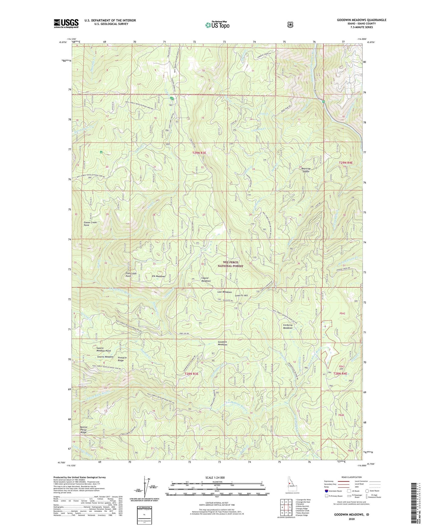
Goodwin Meadows Idaho US Topo Map
Couldn't load pickup availability
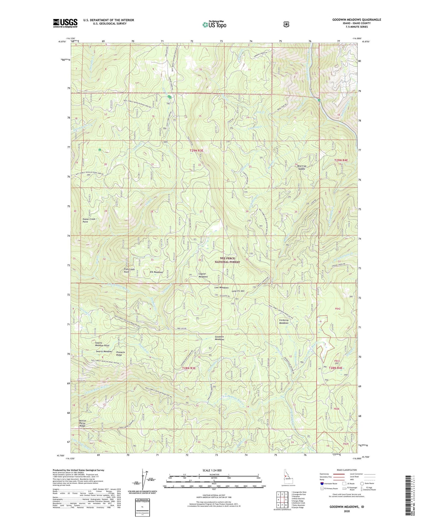
Also explore the Goodwin Meadows Forest Service Topo of this same quad for updated USFS data
2024 topographic map quadrangle Goodwin Meadows in the state of Idaho. Scale: 1:24000. Based on the newly updated USGS 7.5' US Topo map series, this map is in the following counties: Idaho. The map contains contour data, water features, and other items you are used to seeing on USGS maps, but also has updated roads and other features. This is the next generation of topographic maps. Printed on high-quality waterproof paper with UV fade-resistant inks.
Quads adjacent to this one:
West: White Bird Hill
Northwest: Grangeville West
North: Grangeville East
Northeast: Harpster
East: Hungry Ridge
Southeast: Sawyer Ridge
South: Dairy Mountain
Southwest: McKinzie Creek
This map covers the same area as the classic USGS quad with code o45116g1.
Contains the following named places: Beartrap Saddle, Cabin Creek, Camp Creek, Cayuse Meadows, Cold Springs Creek, Corduroy Creek, Corduroy Meadows, Cove Camp, Cove Creek, Dentist Parlor Ridge, Dump Creek, Earthquake Creek, East Fork Bully Creek, Edgeworth Creek, Elk Meadows, Fish Creek, Fish Creek Guard Station, Fish Creek Lookout Tower, Fish Creek Meadow Campground, Fish Creek Point, Fish Creek Recreation Area, Goodwin Creek, Goodwin Meadows, Goose Creek Point, Jungle Creek, KORT-FM (Grangeville), Lick Creek, Little Fish Creek, Lone Fir Hill, Lost Meadows, McAllister Recreation Site, Pinnacle Ridge, Snow Haven Ski Area, South Fork Dump Creek, Swartz Meadow, Swartz Meadow Point, Tepee Creek, Tollgate Creek, Tollgate Ranch, Twin Cabins Creek, White Bird Station