MyTopo
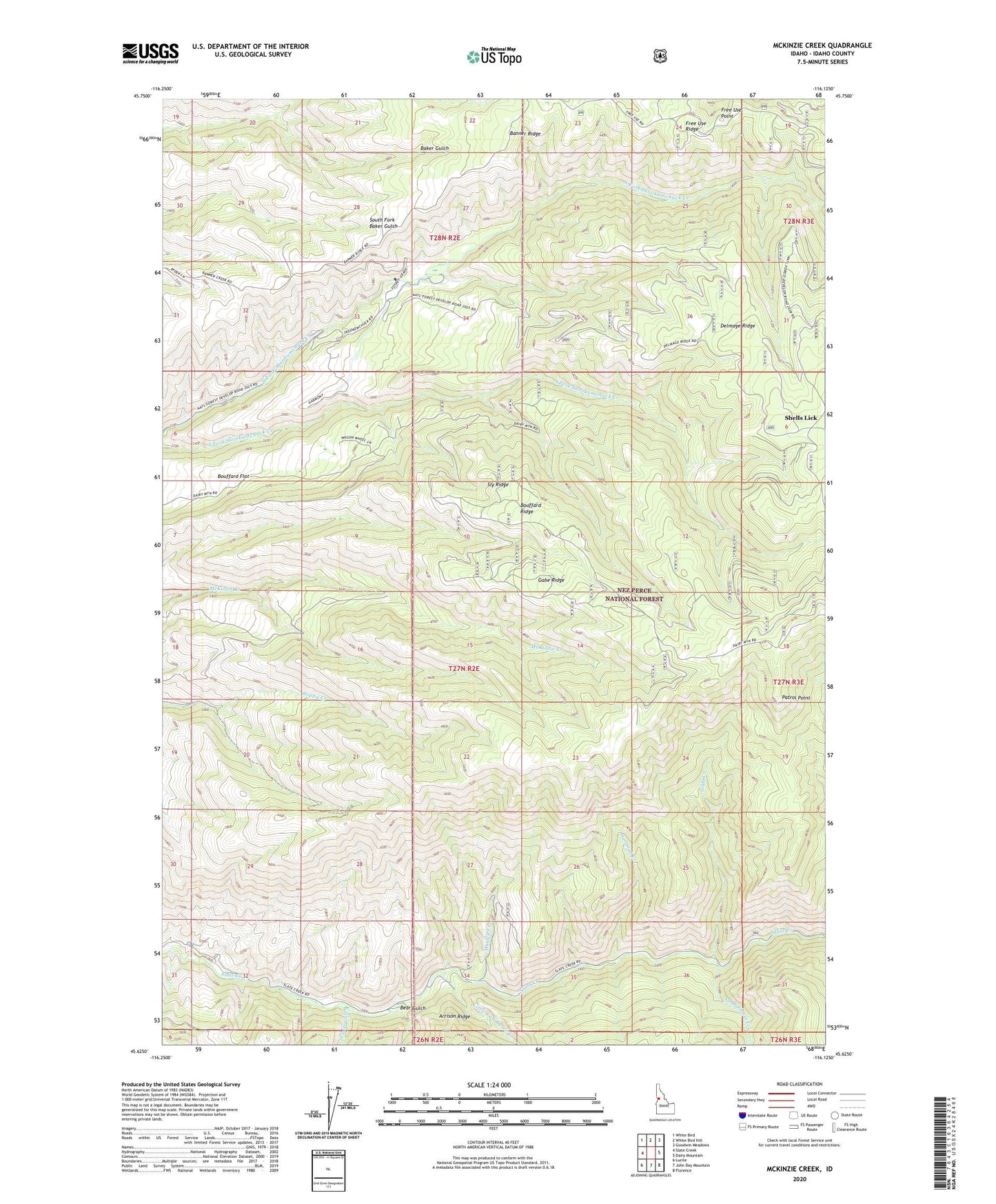
McKinzie Creek Idaho US Topo Map
Couldn't load pickup availability
Also explore the McKinzie Creek Forest Service Topo of this same quad for updated USFS data
2024 topographic map quadrangle McKinzie Creek in the state of Idaho. Scale: 1:24000. Based on the newly updated USGS 7.5' US Topo map series, this map is in the following counties: Idaho. The map contains contour data, water features, and other items you are used to seeing on USGS maps, but also has updated roads and other features. This is the next generation of topographic maps. Printed on high-quality waterproof paper with UV fade-resistant inks.
Quads adjacent to this one:
West: Slate Creek
Northwest: White Bird
North: White Bird Hill
Northeast: Goodwin Meadows
East: Dairy Mountain
Southeast: Florence
South: John Day Mountain
Southwest: Lucile
This map covers the same area as the classic USGS quad with code o45116f2.
Contains the following named places: Banner Ridge, Bear Gulch, Bouffard Flat, Bouffard Ridge, Delmage Ridge, Free Use Point, Free Use Ridge, Gabe Ridge, Hartman Creek, Hurley Creek, Jewitt Gulch, Little Van Buren Creek, No Business Creek, Patrol Point, Shells Lick, Slate Creek Work Center, Slide Creek, Sly Ridge, Wild Horse Corrals