MyTopo
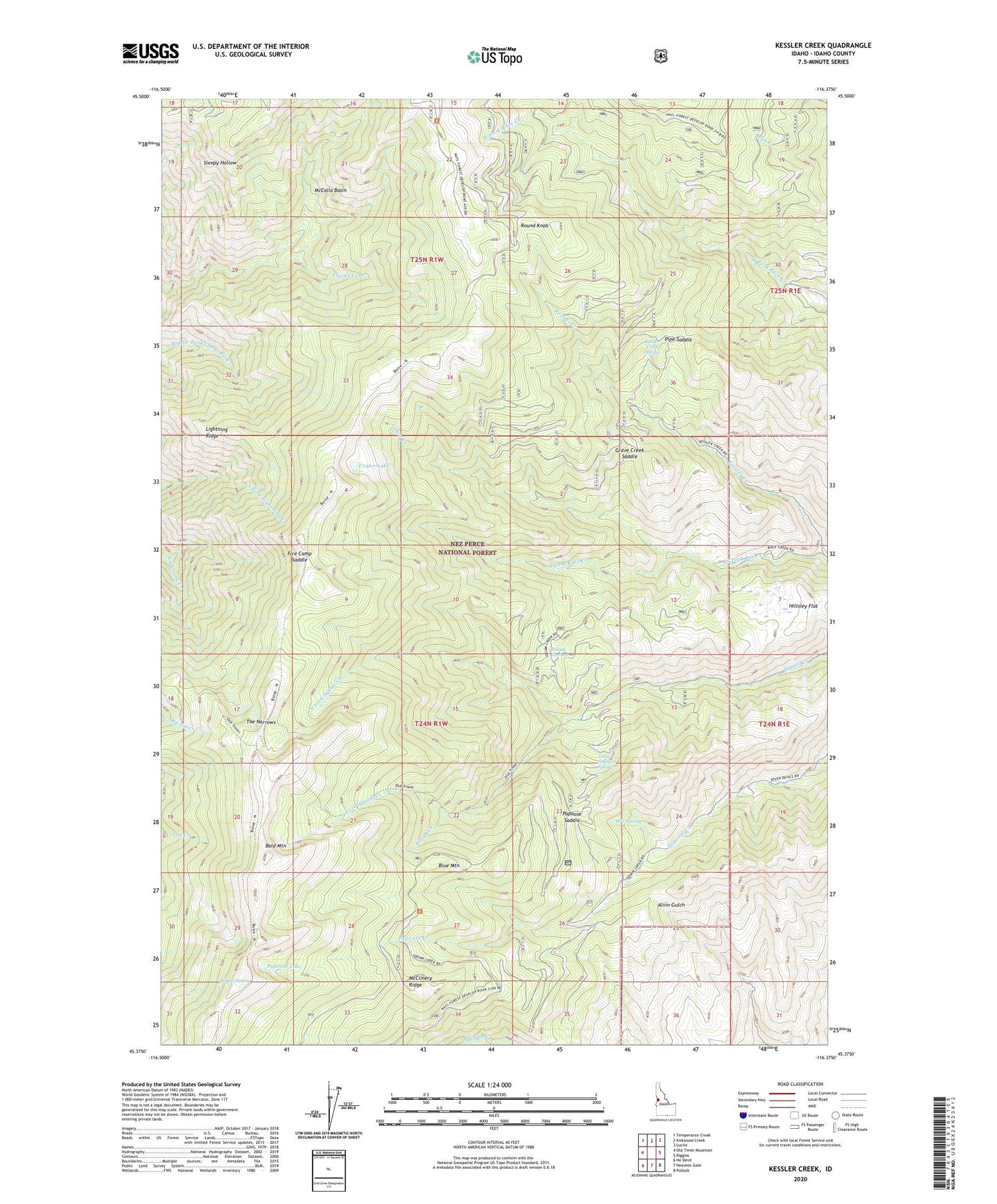
Kessler Creek Idaho US Topo Map
Couldn't load pickup availability
Also explore the Kessler Creek Forest Service Topo of this same quad for updated USFS data
2024 topographic map quadrangle Kessler Creek in the state of Idaho. Scale: 1:24000. Based on the newly updated USGS 7.5' US Topo map series, this map is in the following counties: Idaho. The map contains contour data, water features, and other items you are used to seeing on USGS maps, but also has updated roads and other features. This is the next generation of topographic maps. Printed on high-quality waterproof paper with UV fade-resistant inks.
Quads adjacent to this one:
West: Old Timer Mountain
Northwest: Temperance Creek
North: Kirkwood Creek
Northeast: Lucile
East: Riggins
Southeast: Pollock
South: Heavens Gate
Southwest: He Devil
This map covers the same area as the classic USGS quad with code o45116d4.
Contains the following named places: Bald Mountain, Barton Spring, Bicardi Place, Blue Mountain, Boodry Place, Clarks Ridge, Crater Lake, Fire Camp Saddle, Grave Creek, Grave Creek Saddle, Hiltsley Flat, Hite Spring, Indian Springs, Kessler Creek, Kessler Creek Spring, Lightning Ridge, McCalla Basin, McClinery Ridge, North Fork Squaw Creek, Old Timer Mine, Papoose Campground, Papoose Lake, Papoose Saddle, Pipe Saddle, Rough Creek, Round Knob, Sleepy Hollow, South Fork Squaw Creek, Spotted Horse Mine, The Narrows, Tony Seyfreid Spring, Whiteman