MyTopo
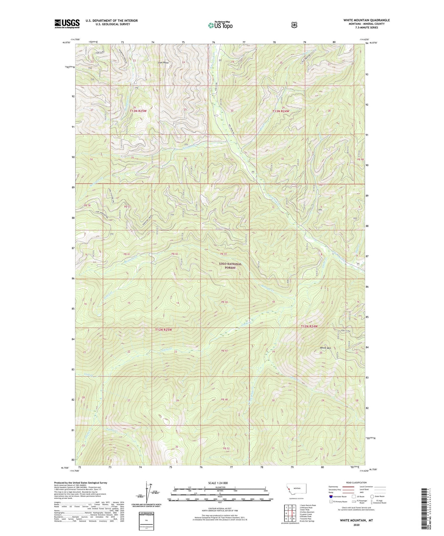
White Mountain Montana US Topo Map
Couldn't load pickup availability
Also explore the White Mountain Forest Service Topo of this same quad for updated USFS data
2024 topographic map quadrangle White Mountain in the state of Montana. Scale: 1:24000. Based on the newly updated USGS 7.5' US Topo map series, this map is in the following counties: Mineral. The map contains contour data, water features, and other items you are used to seeing on USGS maps, but also has updated roads and other features. This is the next generation of topographic maps. Printed on high-quality waterproof paper with UV fade-resistant inks.
Quads adjacent to this one:
West: Schley Mountain
Northwest: Saint Patrick Peak
North: Williams Peak
Northeast: Deer Peak
East: Lupine Creek
Southeast: Lolo Hot Springs
South: Granite Pass
Southwest: Rhodes Peak
This map covers the same area as the classic USGS quad with code o46114g6.
Contains the following named places: Burdette Creek, Cache Creek, Hamilton Nine, Hyde Creek, Irish Creek, Lion Point, Montana Creek, O Neil Creek, Owl Creek, Pebble Creek, South Fork White Creek, Surveyors Creek, White Creek, White Mountain, White Mountain Lookout Tower, Wig Creek