MyTopo
Anderson North Indiana US Topo Map
Couldn't load pickup availability
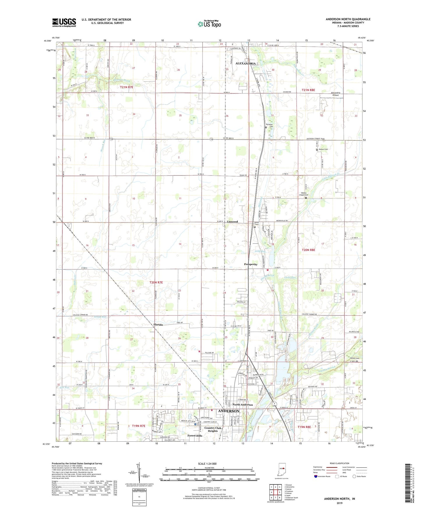
2022 topographic map quadrangle Anderson North in the state of Indiana. Scale: 1:24000. Based on the newly updated USGS 7.5' US Topo map series, this map is in the following counties: Madison. The map contains contour data, water features, and other items you are used to seeing on USGS maps, but also has updated roads and other features. This is the next generation of topographic maps. Printed on high-quality waterproof paper with UV fade-resistant inks.
Quads adjacent to this one:
West: Frankton
Northwest: Elwood
North: Alexandria
Northeast: Gaston
East: Gilman
Southeast: Middletown
South: Anderson South
Southwest: Lapel
This map covers the same area as the classic USGS quad with code o40085b6.
Contains the following named places: Alexandria Airport, Alexandria-Monroe High School, Anderson Fire Department Station 4, Andy Run, Bailey Chapel, Bethany Church, Christ Church, Cloverdale Church, College Corner Elementary School, Community Hospital Airport, Community Hospital Anderson, Donahoo Cemetery, Elm Grove Church, Florida, Florida Brook, Frankton Volunteer Fire Department Station 2, H and R Skylane Airport, Hiawatha School, Highland High School, Holson Cemetery, Indian Creek, Knopp Run, Leach Elementary and Junior High School, Linwood, Little Killbuck Creek, Lucky Run, Madison County, Mount Hope Church, Nelson Brook, Nelson Cemetery, North Anderson, North Anderson Elementary School, Old Canal, Plummer Brook, Prosperity, Richland Township Volunteer Fire Department, Shady Run, Shadyside Park, Shuter Sunset Farms, Smith Cemetery, Township of Lafayette, WAXT-FM (Alexandria), Wesley Chapel Cemetery, Wrench Run