MyTopo
Gaston Indiana US Topo Map
Couldn't load pickup availability
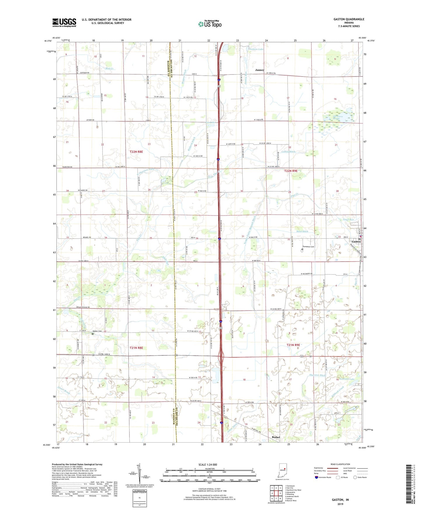
2022 topographic map quadrangle Gaston in the state of Indiana. Scale: 1:24000. Based on the newly updated USGS 7.5' US Topo map series, this map is in the following counties: Delaware, Madison. The map contains contour data, water features, and other items you are used to seeing on USGS maps, but also has updated roads and other features. This is the next generation of topographic maps. Printed on high-quality waterproof paper with UV fade-resistant inks.
Quads adjacent to this one:
West: Alexandria
Northwest: Fairmount
North: Gas City
Northeast: Hartford City West
East: Wheeling
Southeast: Muncie West
South: Gilman
Southwest: Anderson North
This map covers the same area as the classic USGS quad with code o40085c5.
Contains the following named places: Beech Grove Church, Bethel, Bethel Home Place for Boys, Collins Ditch, Emerald Lake, Epworth Church, Gaston, Gaston Police Department, Gaston Post Office, Gaston Volunteer Fire Department, Jackson Lake, Janney, Jim Lake, Kings Chapel, Miami Reserve Christian Camp, North Thurston Ditch, Old Prairie Swamp, Polecat Creek, Prairie Grove Church, Richard Ditch, Sloan Ditch, Steel Ditch, Stem Run, Thompson Cemetery, Thurston Ditch, Town of Gaston, Town Run, Township of Harrison, Township of Van Buren, Township of Washington, Walker Cemetery, Wes-Del Middle School, Yeager Finley Manard Ditch, Zion Church, ZIP Code: 47342